A Taste Of South America
4/17/16 through 5/5/16
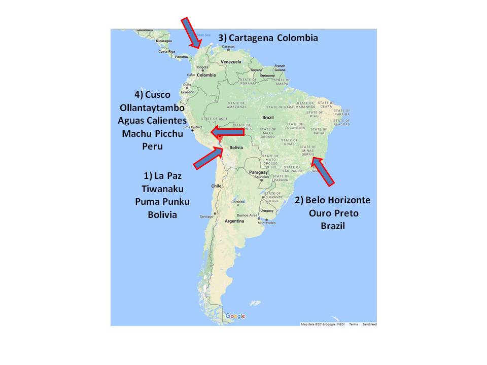
Bolivia - Brazil - Colombia - Peru
Brazil: Belo Horizonte / Ouro Preto
Colombia: Cartagena / Emeralds
Peru: Cusco / The Sacred Valley / Ollantaytambo / Aguas Calientes / Machu Picchu
 We left Los Angeles International Airport for Miami Florida around 9:00 AM Sunday 4/17/16 via an American Airlines Boeing 737-800 aircraft - about a 5.5 hour flight. We had a short layover in Miami and then boarded another American Airlines Boeing 757 and flew for 6.5 hours to La Paz Bolivia. This, and returning via the same route with the same airline proved to be the worse part of the entire trip. I will never fly through Miami again nor will I choose American Airlines as a carrier. Miami has no reasonable places to eat in terms of price or selection. They are all specialty restaurants and expensive. The food we choked down on our layover almost killed us - at least made us ill and we hadn't even left the good old USA yet. American Airlines was expensive. We tried to make some alterations to our trip and +$1000 each was the immediate answer. The South America airlines like LAN and TAM (now the same airline) are much more forgiving with a small fee of $75 for changing itineraries and they will even call you back and try to accommodate your needs. Not American Airlines - they don't do that and they will tell you so. Also, most of the aircraft we flew on in South America via LAN and TAM were Airbus aircraft and configured for more comfort than the Boeing cattle cars American uses. Miami airport security was ridiculous on our return where 2 of 5 security check lanes were open and there was a 30+ minute waite standing in Disneyland like queues. This was very annoying especially just after getting off of a long uncomfortable flight. In South America, we never had to wait for more than a few minutes at most to get through security checks because all lines were open and the process was conducted efficiently - unlike what we experienced with the TSA in the USA.
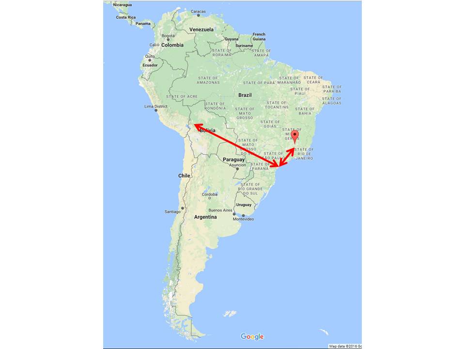
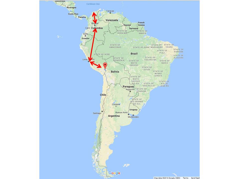
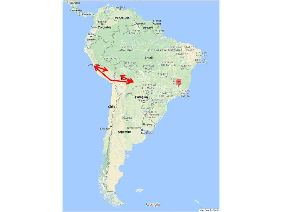
 That said, we traveled almost 11,000 air miles in South America over the 19 day journey. All of our flights and airport experiences in South America were reasonable, unmemorable, and acceptable to say the least. We first flew from Los Angeles to Florida and then to La Paz Bolivia. We visited the ruins at Tiwanaku and Puma Punku and also drove to Lake Titicaca. We then flew to Belo Horizonte Brazil and drove to a little town named Ouro Preto and purchased imperial topaz. A few days later we were off to Cartagena Colombia and visited our friends at the Caribe Jewelry emerald store and museum for a few days. Then off to Cusco Peru and visited Machu Picchu. From there we flew back to La Paz Bolivia and stayed one day and then returned to the USA via Florida.
La Paz -Bolivia
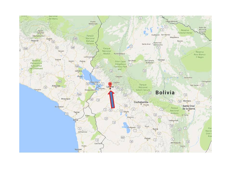
We arrived in La Paz Bolivia early in the morning - like 4:30 AM Monday 4/18/16. Actually, the airport is in a place called El Alto which sits on a large plateau above the valley that is the city of La Paz. We got a taxi to the El Rosario hotel which is in La Paz proper and about a 20 minute taxi ride from the airport.
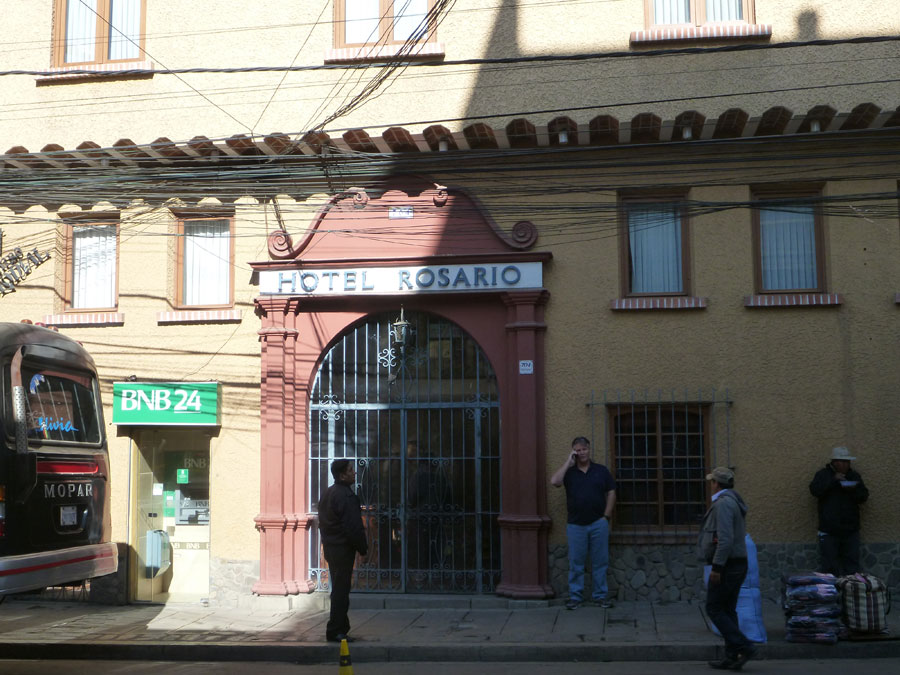
All the hotels are a little scary from the street but really very nice on the inside.
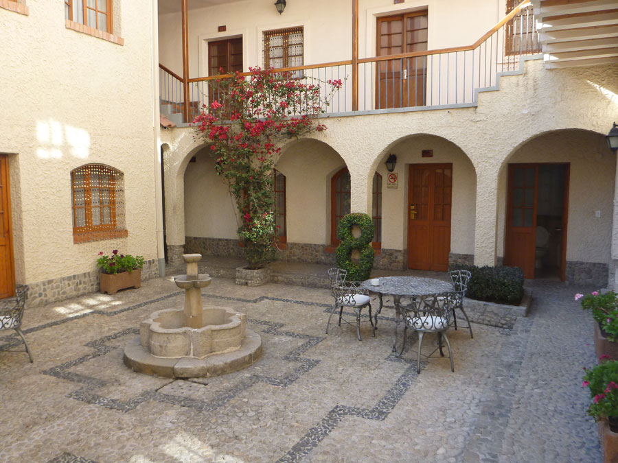 When we arrived we were greeted by a very friendly receptionist who spoke English even though it was early in the morning - I mean just before sunup early. Fortunately, they had a room we could occupy immediately. We laid down for a while and took a well-disserved nap. We were now at 12,000 feet elevation and acclimation to the altitude was in order. The room was clean and comfortable but up several flights of stairs. At 12,000 feet altitude, a couple of flights of stairs had me stopping several times in an attempt to catch my breath.
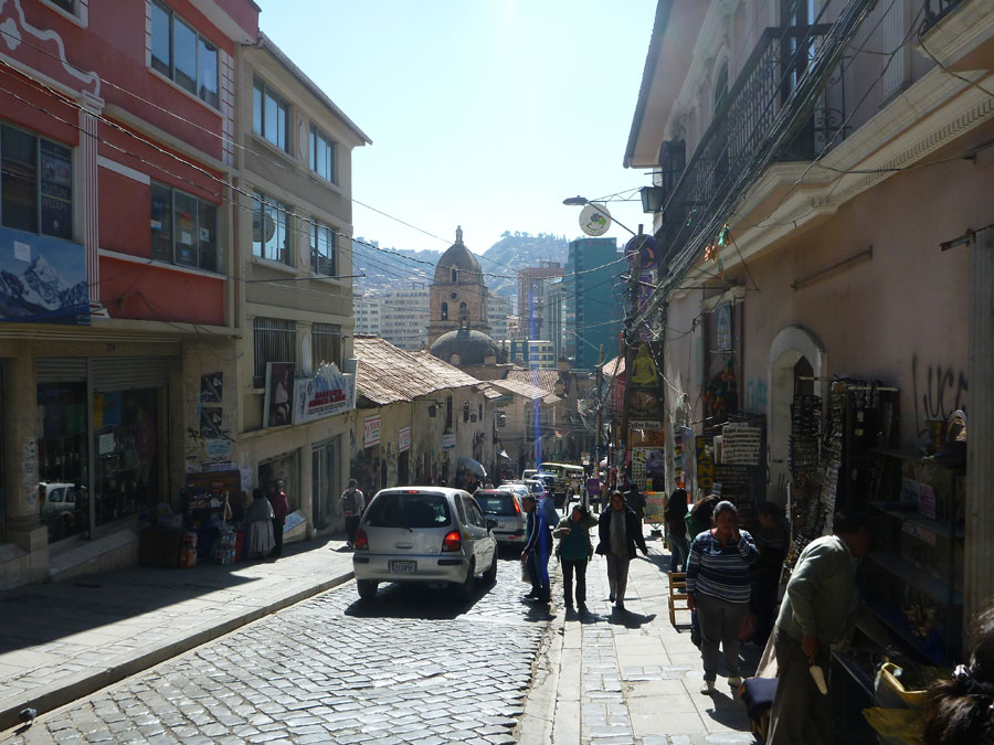
After a couple hours of rest, we ventured off into the city. It was still morning and a bright and sunny day. Fortunately what there was to see was down hill from the hotel so we headed for the historic Basilica of San Francisco at the center of town. This began our investigation of La Paz.
On the way to the basilica we ate breakfast at a very old, well hidden, and hard to find local restaurant recommended by the hotel. We were the only patrons. Frank had a little headache from the altitude so we had our first and only go at drinking coca tea which is supposed to help with altitude sickness. To me the tea tasted like boiled weeds and had no effect. Although, I was not feeling poorly from the altitude. The tea didn't seem to have much effect on Frank either. We both had some sort of Bolivian fried eggs and bacon that was prepaired in a small home style kitchen next door to the dining area. All in all it was pretty primitave but the food and service was good.

The picture is the view out of the window of the restaurant. Notice the bevy of wires on the pole. This is typical of countries I have been to like Cambodia, Guatemala, Mexico, and Bolivia. It always amazes me that the whole thing doesn't just blow up in a big poof of smoke.
 The Basilica of San Francisco is a Catholic church under the advocation of Francis of Assisi in the square that bears its name "Plaza San Francisco". It was built between the sixteenth and eighteenth centuries in the so-called baroque-mestizo style. In 1548, the Convent of San Francisco was founded along the river Choqueyapu by Fray Francisco de Morales. In August 1549 the construction of the first Church of San Francisco began, which was concluded in 1581. Between 1608 and 1612 the first church collapsed as a result of a snowfall of considerable proportions. Between 1743 and 1744 the construction of the present church began. In 1753 is finished with the closure and the roof of the church's dome. On April 23, 1758, it was consecrated.
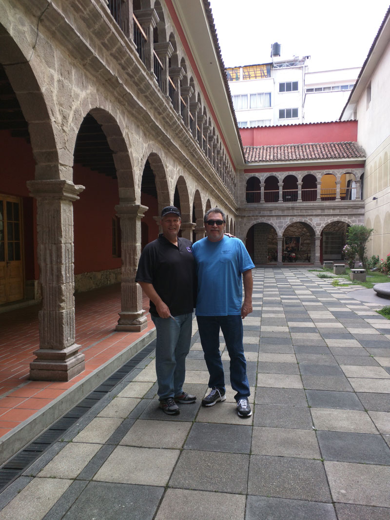
Frank and Mark in the plaza of the church.
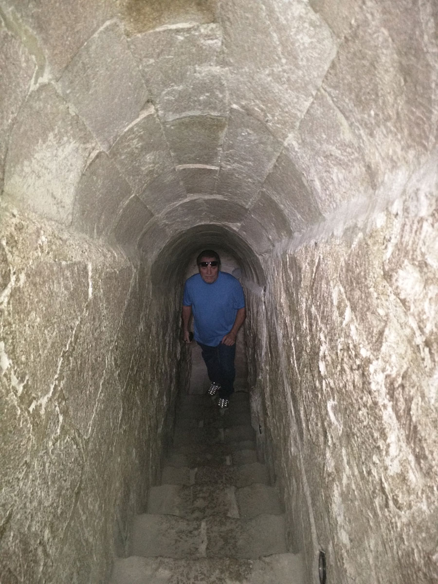
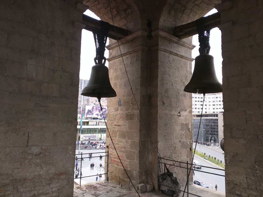
Mark walking up stair tunnel to the roof to see the bells. We were allowed to go see the bells but were instructed not to ring the bells. What do you think Mark and Frank did?
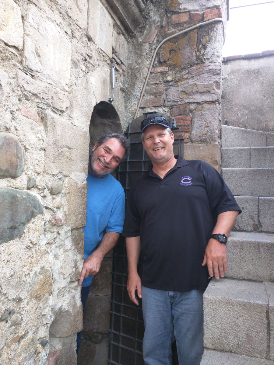
Mark and Frank on the roof of the church at the bell tower. See the video to see if they could resist ringing the bells.

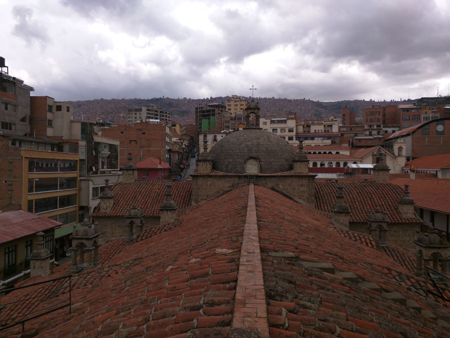
Roof of San Francisco Church.
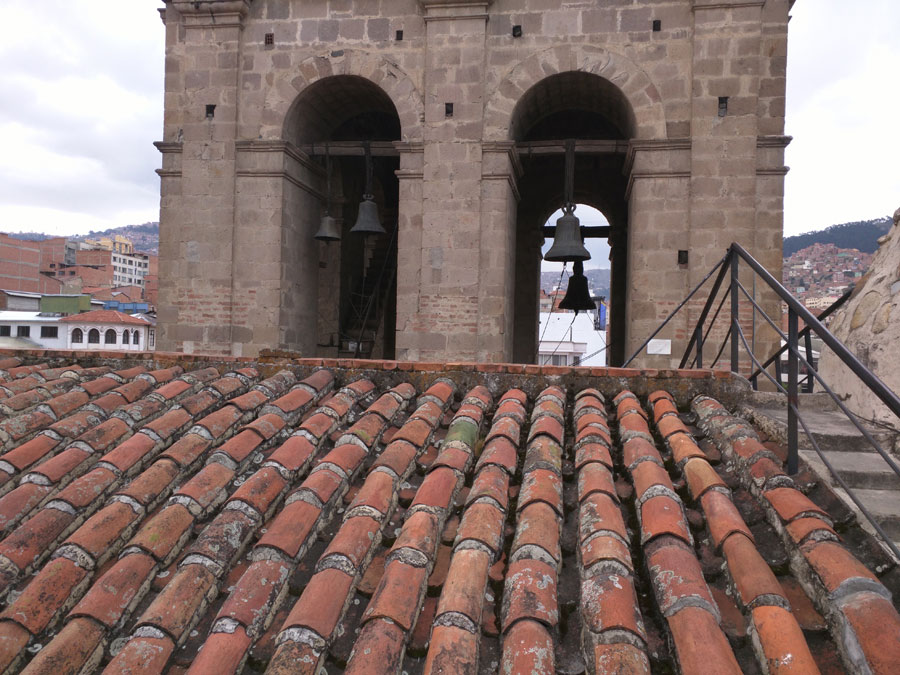
Bell tower of the San Francisco Church.
Although the church and surrounding area was beckoning us, it was a priority for us to find transportation to the ruins at Tiwanaku and Puma Punku which was the purpose of our visit. We were reasonably sure we could find transportation in one form or another between where we were and our hotel.
On our way back to the hotel - uphill - it started raining so we took shelter in a coffee shop.
We met a couple from Canada and Switzerland. It was interesting discussing American politics with them. They knew much more than I thought they would about the Clinton Trump debacle. It rained pretty hard for an hour or so. When we could breathe again, we continued on our journey in a light rain. We eventually found a travel agent and booked seats on a tour bus to Tiwanaku and Puma Punku the next day. Little did we know the joys that would bring us - especially Frank.
So a little trivia about La Paz is in order. Nuestra Señora de La Paz (English: Our Lady of Peace), commonly known as La Paz, named Chuqi Yapu (Chuquiago) in Aymara, is Bolivia's third-most populous city (after Santa Cruz and El Alto),the seat of the country's government, and the capital of La Paz Department. It is located on the western side of Bolivia at an elevation of roughly 3,650 m (11,975 ft) above sea level. It is, de facto, the world's highest administrative capital. While the official capital of Bolivia (and its seat of justice) is Sucre, La Paz has more government departments. In May 2015, La Paz was officially recognized as one of the New 7 Wonders Cities together with Vigan, Doha, Durban, Havana, Beirut, and Kuala Lumpur. The city sits in a bowl surrounded by the high mountains of the altiplano. As it grew, the city of La Paz climbed the hills, resulting in varying elevations from 3,200 to 4,100 m (10,500 to 13,500 ft).
Overlooking the city is towering triple-peaked Illimani, which is always snow-covered and can be seen from many parts of the city, including from the city of El Alto. It has the second highest peak in Bolivia at 6,438 m (21,122 ft).
As of the 2008 census, the neighboring city had a population of 877,363. La Paz Metropolitan area, formed by the cities of La Paz, El Alto, and Viacha, make the most populous urban area of Bolivia, with a population of 2.3 million inhabitants and surpassing the metropolitan area of Santa Cruz de la Sierra.
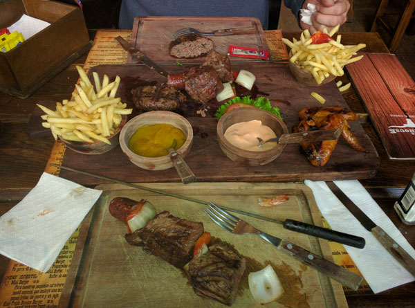
We ate dinner at a upscale steak house located about half way down the hill toward the center of town. It was as far away from the hotel as Frank and I wanted to walk - downhill. It was Frank and my first go at eating lama. It came on a shish kebab with other meats. I would not have known it was lama if someone had not told me. Note: food tastes kind of bland at this altitude.
Tuesday 4/19 - The tour bus guide showed up in front of our hotel a little late and a half dozen of us walked down the street a ways to find a small van type bus awaiting our arrival. At this time it was not full but was already crowded. We all piled in and claimed our ground. The van finally left and we thought we were on our way. A few miles down the road the van would stop and pick up a couple more people. Each time this happened, Frank would start telling the tour guide in Spanish that there was not enough room - that he was not to let any more people in the van - on and on he would go. Well as it turned out, every seat was full by the time we had picked everyone up - about 11 or 12 I think which included the driver and tour guide. Anyway, we were packed into this van like little sardines and off we all went on a 2.5 hour drive to see Tiwanaku.
In the van we met couples from Tasmania, Germany, Chile, and France. Friendly people who really opened up as Frank supporters when they were packing the van as full as possible with people.
It is a couple of hour drive from La Paz to the Tiwanaku and Puma Punku ruins which are basically the same place. The scenery on the drive there is of a vast plateau that consists of mostly farmland but at a very high elevation.
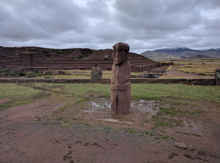
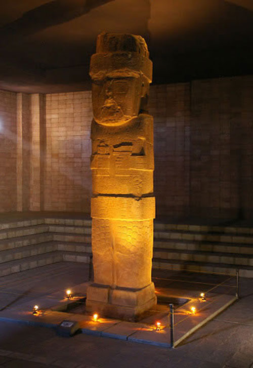
Tiwanaku
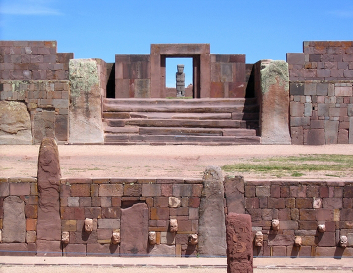
 Tiwanaku (Spanish - Tiahuanaco) is located near the southern shores of Lake Titicaca on the Altiplano, at an altitude of 3,850 m (12,631 ft.), in the Province of Ingavi, Department of La Paz. Most of the ancient city, which was largely built from adobe, has been overlaid by the modern town. However, the monumental stone buildings of the ceremonial center survive in the protected archaeological zones.
The spiritual and political center of the Tiwanaku culture began as a small settlement which later flourished into a planned city between 400 A.D. and 900 A.D. However, there are those who believe the area around Tiwanaku may have been inhabited as early as 1500 B.C. or earlier as a small agricultural village. The original port of Tiahuanacu was built on the shores of Lake Titicaca less than 600 feet away, but whose southern coastline now lies some 12 miles away. According to author / researcher, Graham Hancock, “Fingerprints of the Gods,” scholars including Arthur Posansky, Becker, Kohlschutter, and Muller have concluded from astronomical investigations of the ecliptic, that the site may well have been constructed as far back as 12,000 B.C. making Tiwanaku one of the oldest city temples on the planet, if not the oldest, if the astronomical calculations can be proven! However, the name by which Tiwanaku was known to its inhabitants has been lost, as the people of Tiwanaku had no written language and were supposedly ignorant of the existence of the wheel.
Tiwanaku (Spanish - Tiahuanaco) is located near the southern shores of Lake Titicaca on the Altiplano, at an altitude of 3,850 m (12,631 ft.), in the Province of Ingavi, Department of La Paz. Most of the ancient city, which was largely built from adobe, has been overlaid by the modern town. However, the monumental stone buildings of the ceremonial center survive in the protected archaeological zones.
The spiritual and political center of the Tiwanaku culture began as a small settlement which later flourished into a planned city between 400 A.D. and 900 A.D. However, there are those who believe the area around Tiwanaku may have been inhabited as early as 1500 B.C. or earlier as a small agricultural village. The original port of Tiahuanacu was built on the shores of Lake Titicaca less than 600 feet away, but whose southern coastline now lies some 12 miles away. According to author / researcher, Graham Hancock, “Fingerprints of the Gods,” scholars including Arthur Posansky, Becker, Kohlschutter, and Muller have concluded from astronomical investigations of the ecliptic, that the site may well have been constructed as far back as 12,000 B.C. making Tiwanaku one of the oldest city temples on the planet, if not the oldest, if the astronomical calculations can be proven! However, the name by which Tiwanaku was known to its inhabitants has been lost, as the people of Tiwanaku had no written language and were supposedly ignorant of the existence of the wheel.
The maximum expression of this culture is reflected in the civic - ceremonial organized spatially with a centre oriented toward to the cardinal points, constructed with impressive ashlars stones carved accurately and equipped with a complex system of underground drainage that was controlling the flow of rain waters.
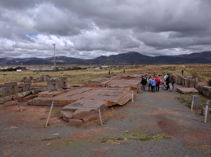
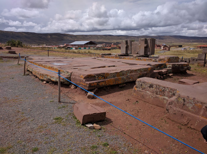
There are a lot of theories and much has been written about Tiwanaku and Puma Punku. But remember, these people had no written language so all the theories are just that - theories. I will say that it is abundantly clear, after being at the site and taking it all in, that I am unsure that there is anyone alive that truly knows the when's, how's, and why's of the Tiwanaku ruins and most certainly the Puma Punku site which is thought to be much older than the Tiwanaku site.
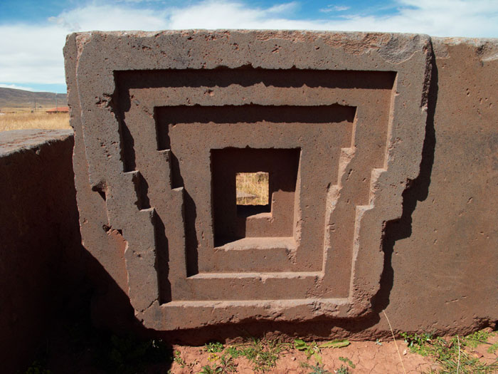
The most intriguing thing about Tiwanaku and Puma Punku is the stonework. We did not see any granite at Tiwanaku or Puma Punku. However, at both places, some of the monoliths are carved in volcanic andesite and the remainder are carved in red sandstone. Andesite has a composition that is intermediate between basalt and granite and derives its name from the Andes Mountains of South America.
So let's compare hardness and weight of these materials.
Material | Moh's Hardness | Density g/cm3 |
Granite | 6-7 | 2.7 |
Andesite | 7 | 2.2 |
Red Sandstone | 6.5-7 | 2.35 |
As you can see, andesite and red sandstone are just as hard as granite but granite is slightly heavier. Working these materials, even with modern technology, requires the use of heavy equipment to move the stone and diamond abrasive cutting tools to cut and polish the stone. I have worked with granite and cutting and polishing even the simplest of cuts with modern equipment is difficult work and time consuming. The only way to get truly flat surfaces and precision cuts is by using machinery. Accomplishing this by hand is nearly impossible. It is truly remarkable that these ancient people were able to move, cut, and polish these materials in a time that had no equipment, machinery, or written language. Obviously, how they did it remains a mystery but in my mind, the bigger question is why they did it. It must not have been as difficult for them as we perceive it to be or they would not have done it in the first place. Remember, these people lived on this high plateau at some 12,000+ feet elevation where there and few resources. It is cold and wet. Life in and of itself is harsh. Why do something that is even more difficult by moving some of the heaviest material around and then carving materials that are as hard as granite? We are definitely missing something here!

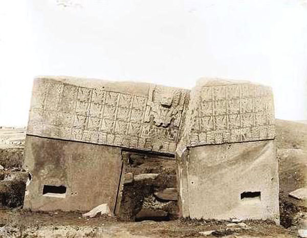
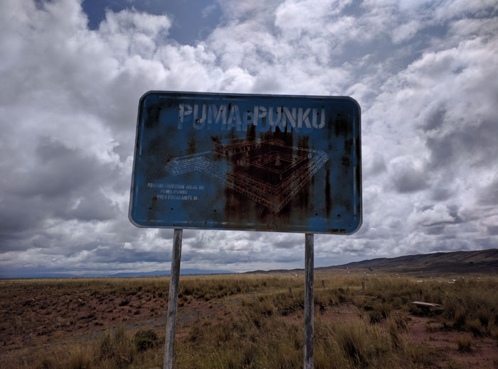
Puma Punku
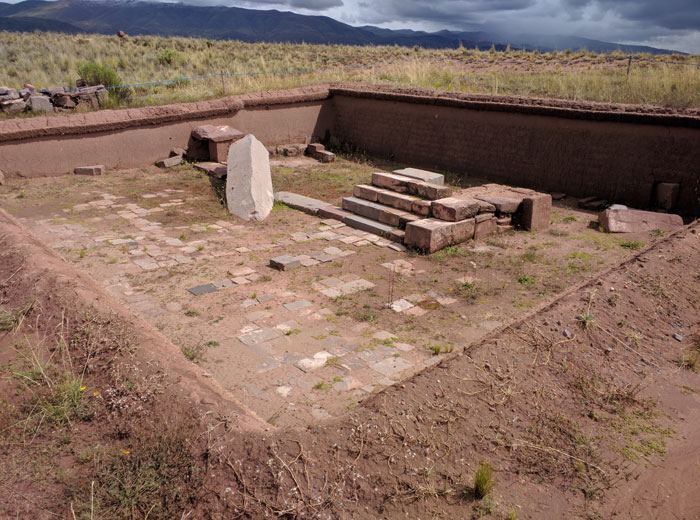
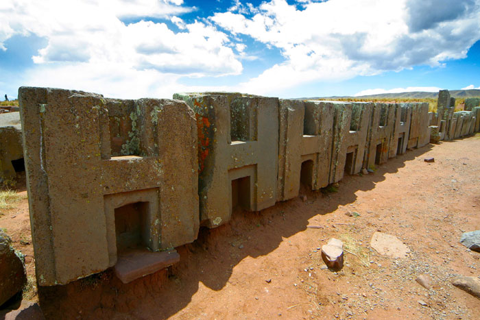
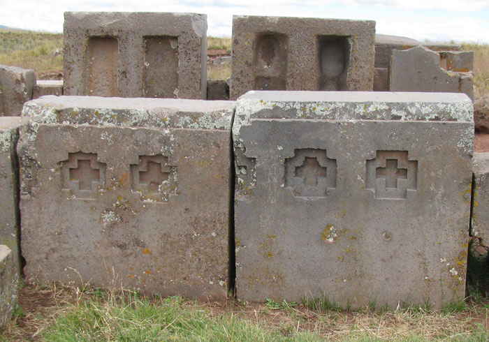
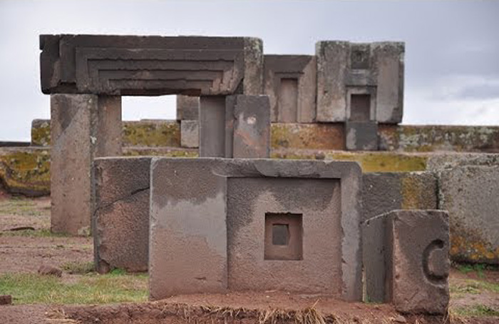
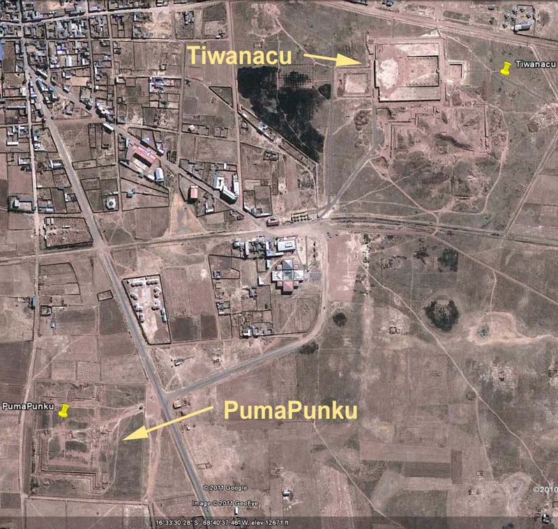 Pumapunku or Puma Punku "The Door of the Puma" is just down the road from Tiwanaku. You can easily walk from one site to the other. Puma Punku is a smaller site than Tiwanaku covering only a couple of acres. Puma Punku has not been excavated to near the extent of Tiwanaku. Puma Punku is thought to be part of a large temple complex or monument group that is part of the Tiwanaku site. Surveys in the area separating the Puma Punku and Kalasasaya complex using ground-penetrating radar, magnetometry, induced electrical conductivity, and magnetic susceptibility indicate that there is a vast complex still buried underground. However, Puma Punku is thought to be much older than Tiwanaku.
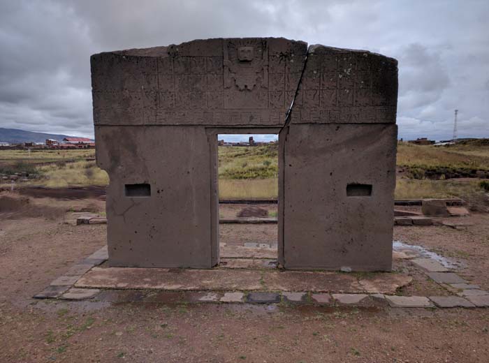
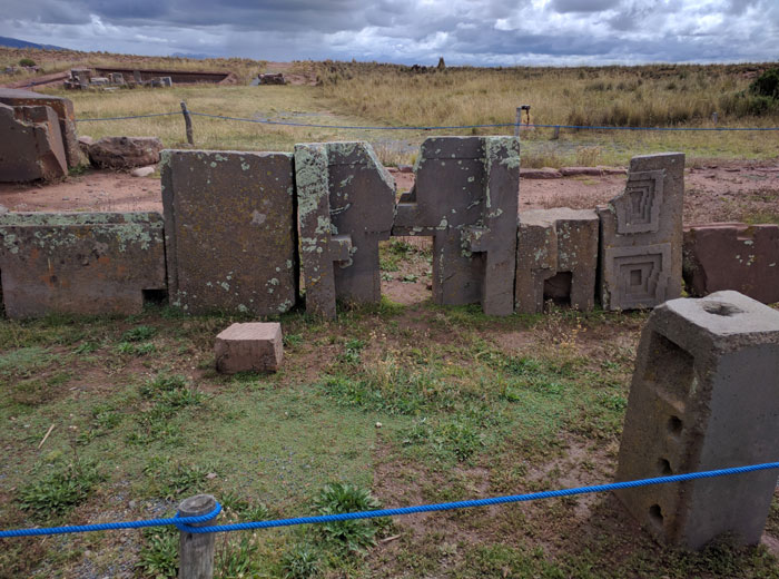
The most intriguing thing about Puma Punku is the stonework. The red sandstone and andesite stones were cut in such a precise way that it’s as if they were cut using machinery and diamond tools. Some blocks can fit perfectly into and lock with each other. Another phenomenon of engineering is that many of the stones weigh up to 800 tons. Interviews with modern day stone masons have revealed that even with today’s advanced technology, it would be almost impossible to replicate the precision observed in the stones found at Puma Punku.
According to the local myths, Puma Punku is related to the Gods and the time of the first creation. The legend states that the first inhabitants had supernatural powers and were able to move stones from the ground and carry them through the air using sounds. The Inca tribes accept those legends and deny that their ancestors had anything to do with the building of Puma Punku. In fact, one legend says that Puma Punku was built in one night by the gods.
For me, Puma Punku looks like the stone quarry of a bunch of truly talented stone masons who had at their disposal some unique machinery and knowledge. It would be difficult, even with today's modern technology, to reproduce these carvings with 5 axis milling machines and diamond abrasive tools. To complicate matters, there are no evident tool marks on any of the cut surfaces making it more difficult to discern how the cuts were made. When you look around the area nothing makes any sense as intricately cut stones are strewn all over the place as though they were randomly thrown about and then stood up where they fell. All different shapes and sizes all over the place. There must be more to this than meets the eye. More importantly, it appears to me that Puma Punku and Tiwanaku are strongly related as the back side of the Gateway of the Sun displays many of the same extreme stone cutting skills (inside 90 degree cuts) as does the stone work at Puma Punku. The Gateway of the Sun is made from andesite stone which may as well be granite. So I believe that it could be possible that the Tiwanakan people learned the trade from the folks who created Puma Punku and used similar machinery to carve these intricate patterns into the stone. But, its more likely, the stone was cut and polished by the folks who created Puma Punku and the Tiwanakan people simply found it that way and wove it into their history. I am absolutely certain that these carvings were not accomplished by hand by primitive people with primitive tools.
We had a pretty good lunch at the Tiwanaku ruins put on by the people who run the place. It was an extra cost and not included in the tour. We purchased some souvenirs, packed ourselves back into the van and off to La Paz. We got back to the hotel in the late afternoon.
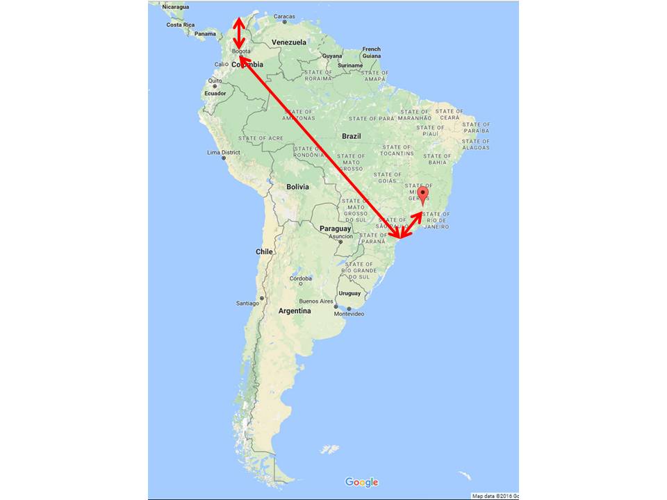
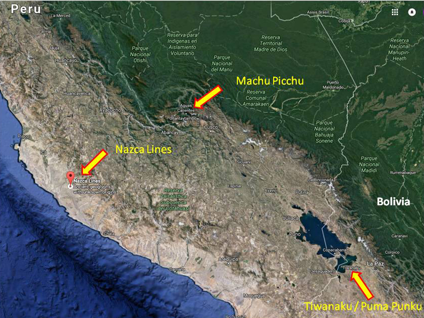 I had an interesting observation while looking at a map of Peru. The proximity of these mysterious sites - the lines at Nazca, Machu Picchu, and Tiwanaku - are all fairly close to one another in the same part of the world. There must be a reason for this. I think there is more to be found in the region that has remained hidden for all these years.
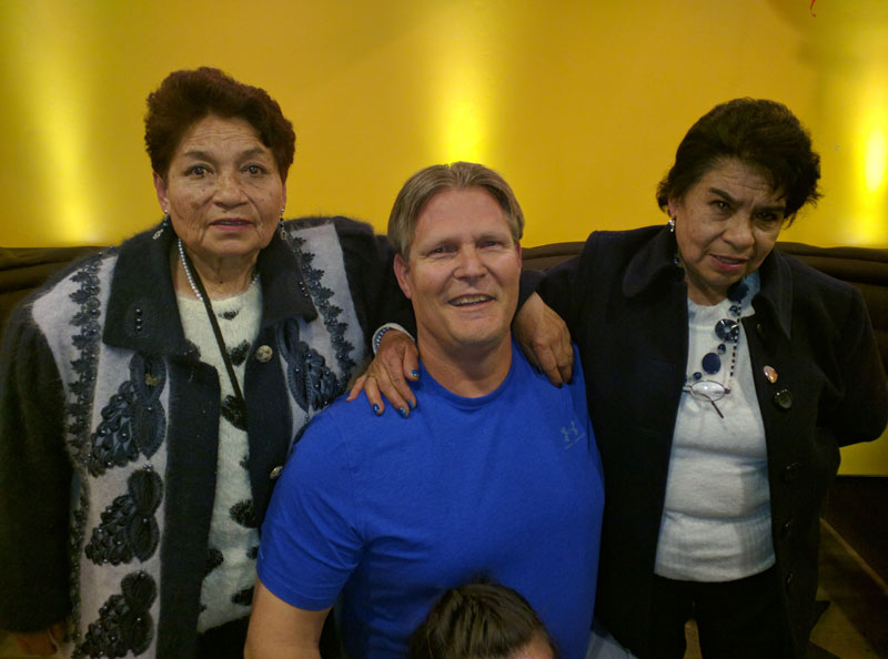 Frank had contacted the sisters (2) of his first son's mother (Sonia) and one of their children's daughters husband picked us up at the hotel and took us to have dinner with the family at a pizza establishment in down town La Paz - kind of like a Chuck E. Cheese in the US.
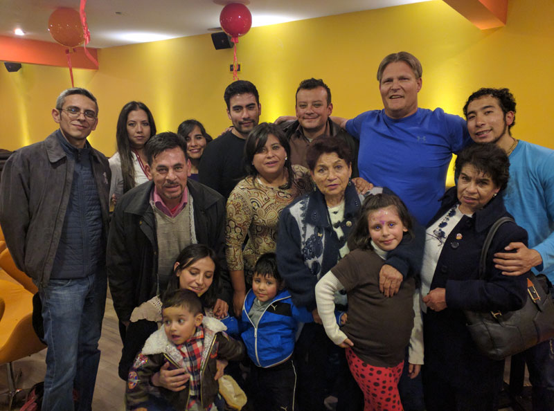 We met the entire family of Frank's first son's mother Sonia who has not been to Bolivia to see her two sisters for many years.
What an awesome, friendly group of people. We ate and talked and had a really wonderful evening.
We met the entire family of Frank's first son's mother Sonia who has not been to Bolivia to see her two sisters for many years.
What an awesome, friendly group of people. We ate and talked and had a really wonderful evening.
Wednesday 4/20
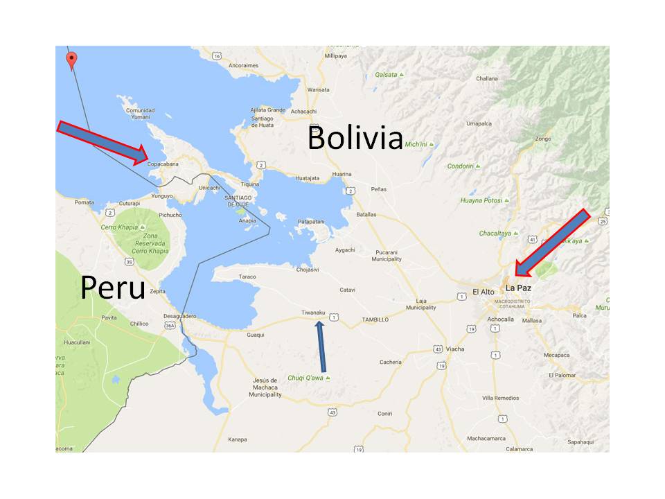
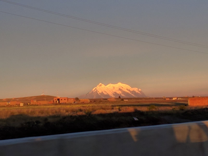
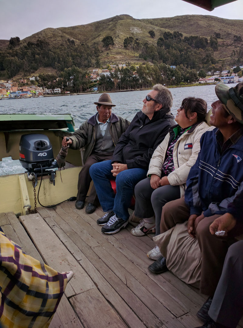
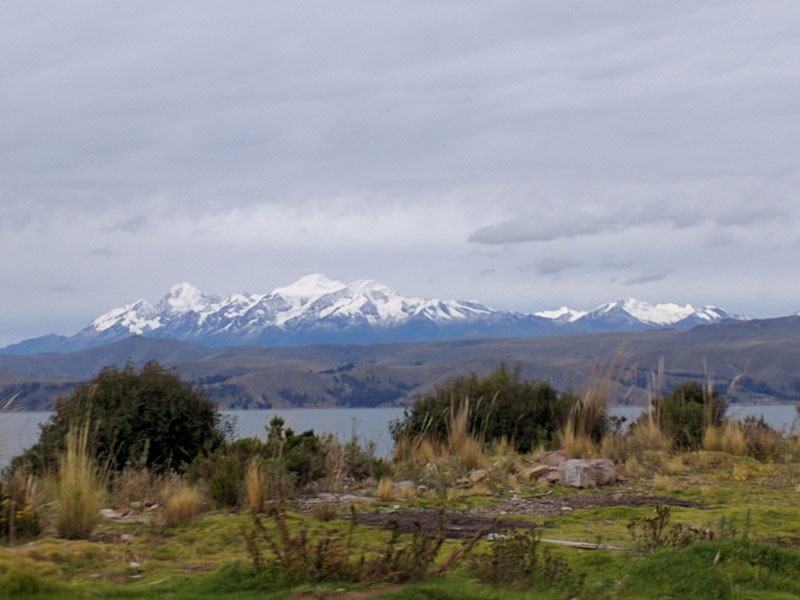
Wendy, Sonya's sisters daughter, and her husband took Frank and I on the long journey to see lake Titicaca and Copacabana beach. Copacabana beach is a popular beach that sits on the shores of lake Titicaca not far from the Peruvian border. This turned out to be a 10 hour round trip journey from La Paz.
The mountains you see in the pictures are all in excess of 5182 m (17,000 ft) elevation with some being more than 6,096 m (20,000 ft) tall. Apparently La Paz is a climbers paradice where we ran into several groups of European climbers, one staying at our hotel, acclimating in La Paz for a week or more so they could go climb one mountain or another. These mountains are ice covered year-round. However, this covering and the associated glaciers are diminishing rapidly due to global warming as is being witnessed all over the world.
 We left La Paz and drove route 2 along the high-altitude basin 3,810 m (12,500 ft), located
between the eastern and western Andean cordilleras (an extensive chain of mountains or mountain ranges),
that covers an area of 57,000 km2 (22,008 miles2).
We left La Paz and drove route 2 along the high-altitude basin 3,810 m (12,500 ft), located
between the eastern and western Andean cordilleras (an extensive chain of mountains or mountain ranges),
that covers an area of 57,000 km2 (22,008 miles2).
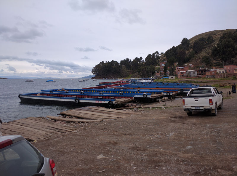
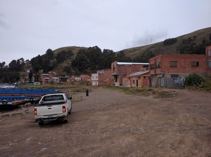
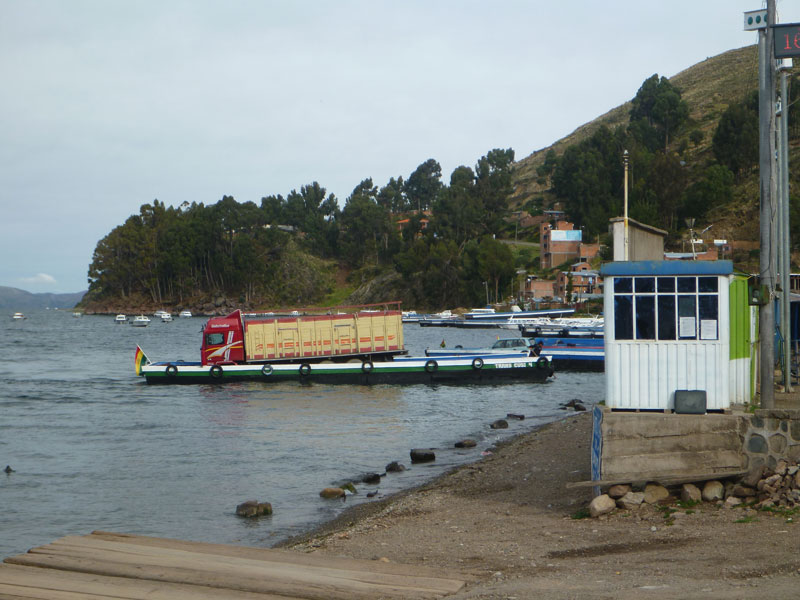
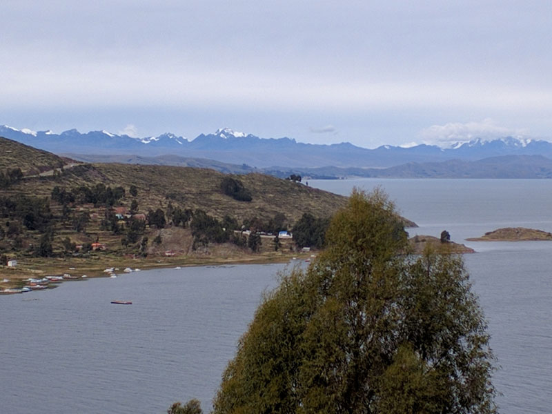
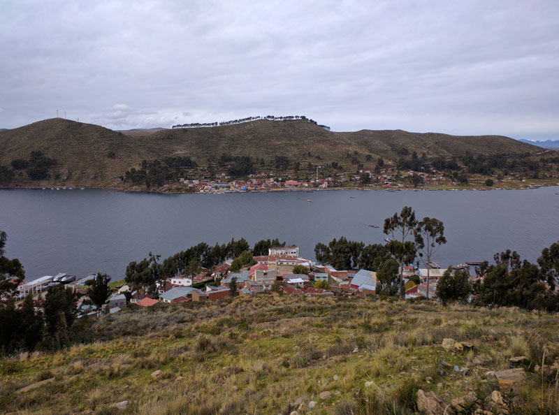
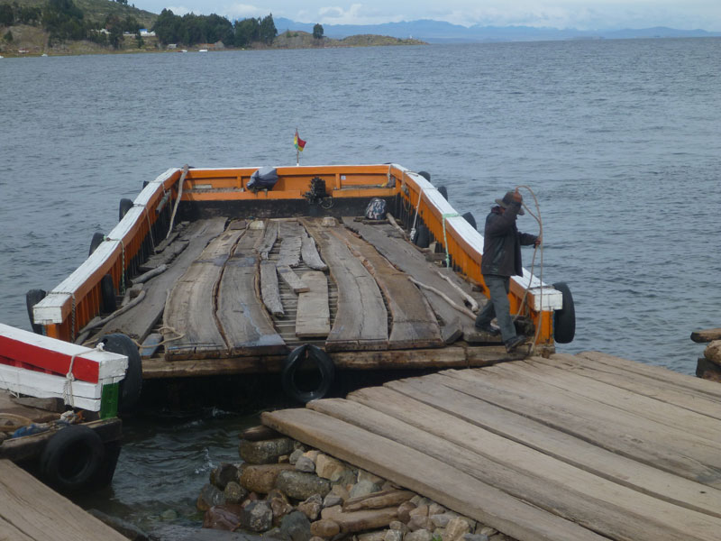 It took a couple of hours for us to arrive at Estrecho de Tiquina. This is where the road ends and, if you wish to continue, a "ferry" must taken across a fresh water channel of lake Titicaca to a little town called Mercado de San Pedro de Tiquina.
Most of the "ferry" operators only speak the local language and will not speak to you in spanish and will not acknowledge you if you speak to them in spanish.
It took a couple of hours for us to arrive at Estrecho de Tiquina. This is where the road ends and, if you wish to continue, a "ferry" must taken across a fresh water channel of lake Titicaca to a little town called Mercado de San Pedro de Tiquina.
Most of the "ferry" operators only speak the local language and will not speak to you in spanish and will not acknowledge you if you speak to them in spanish.
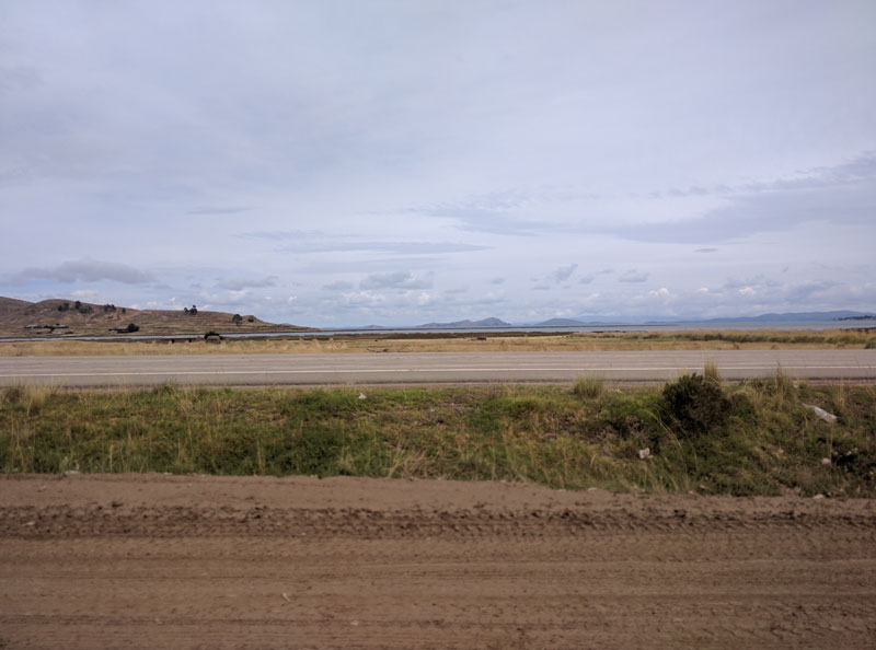
It was windy and a little cold but the scenery is breathtaking and the crossing is amazing.


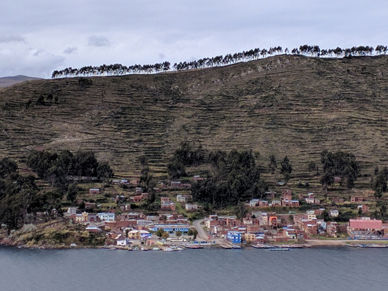
The terracing of the hills - everywhere - is what blew my mind. Mile after mile, the hills are all terraced. I am not sure who did this, in fact, I am not sure anyone knows who actually did this but it is as amazing as Tiwanaku. It is known that the area adjacent to Lake Titicaca has long been a major center of agricultural production and dense human populations. It was the home of several important pre Columbian civilizations. Over the past 8,000 years, the environment of the basin has been transformed into a highly patterned, artificial landscape. The construction of raised fields (waru waru, suka kollas), stone-faced terraces (andenes), sunken gardens (q’ochas), and irrigated pasture (bofedales) are thought to be related to an agricultural infrastructure. These terraces were mostly abandoned long ago and only few are in use today in Bolivia and Peru.
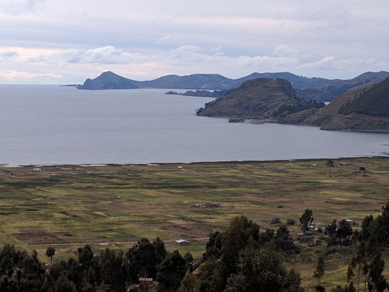
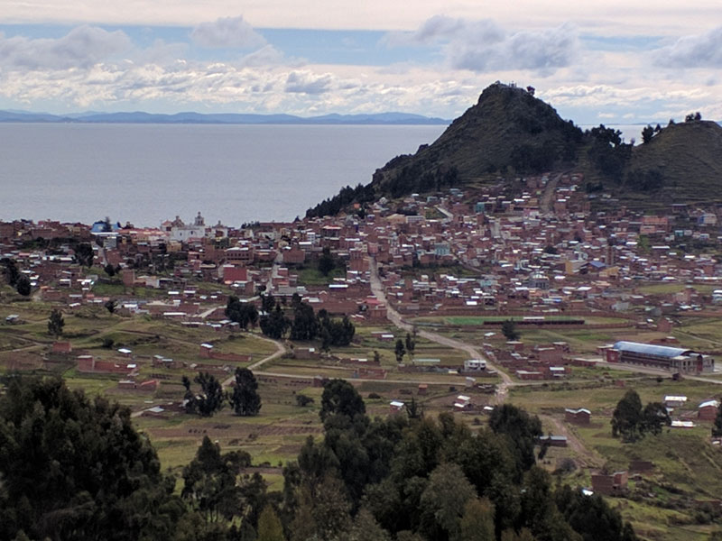
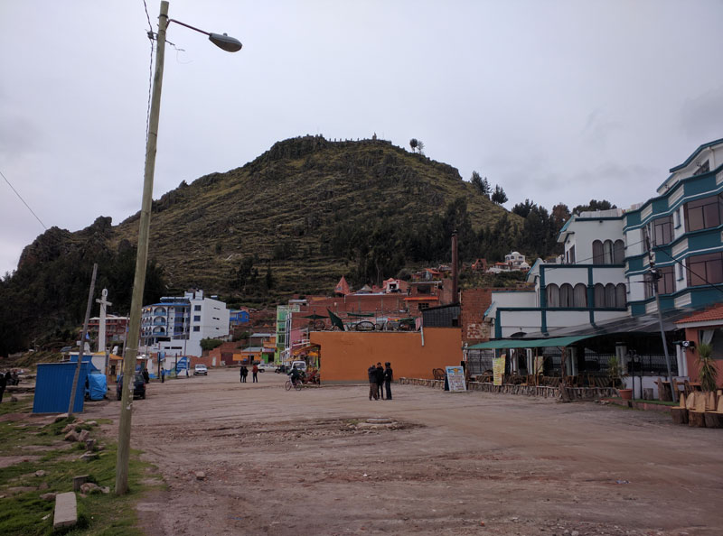
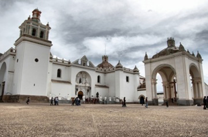
We finally arrived at Copacabana beach, a popular resort destination for foreign travelers and locals alike. It is a relatively small town. This is the original Copacabana beach actually lending its name to the beach in Rio de Janeiro, Brazil. The name derives from the Aymara kota kawana, meaning "view of the lake", and the region was revered by the Inca even before the Spaniards built their chapel of the Virgin and turned it into a Catholic pilgrimage site.
We ate trout at one of the many restaurants that sit on the shoe of the lake. Even though I am not that fond of fish, it was quite good. The restaurant serves trout many different ways and I had the garlic trout - I think.
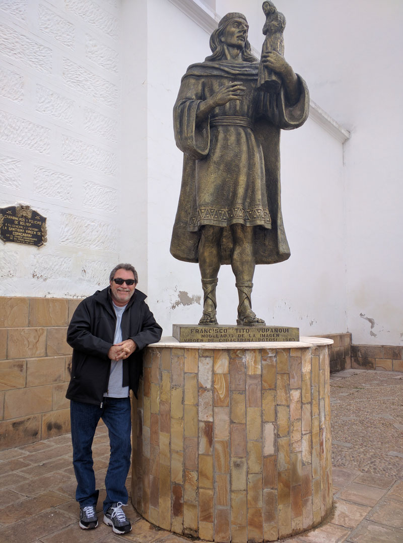
A trip to Copacabana beach would not be complete without stopping at the chapel of the Virgin. The Virgen de la Candelaria in Copacabana is a statue of the Virgin Mary sculpted by an Inca craftsman in 1576. The statue of the "Dark Virgin of the Lake" is the most important pilgrimage destination in Bolivia and is believed to work miracles. The Black Madonna was moved from its shrine to a chapel in 1583, which was enlarged by the Spanish in a Moorish style in 1619. The statue soon gained a reputation throughout Bolivia and Peru for working miracles. The present Basilica de la Virgen de Candelaria was completed in 1805.
Our trip back to La Paz found us navigating the streets of El Alto after dark. This was quite an experience as much of the main street through El Alto and its suburbs is undergoing a transformation where much construction is going on to modernize several miles of the city.
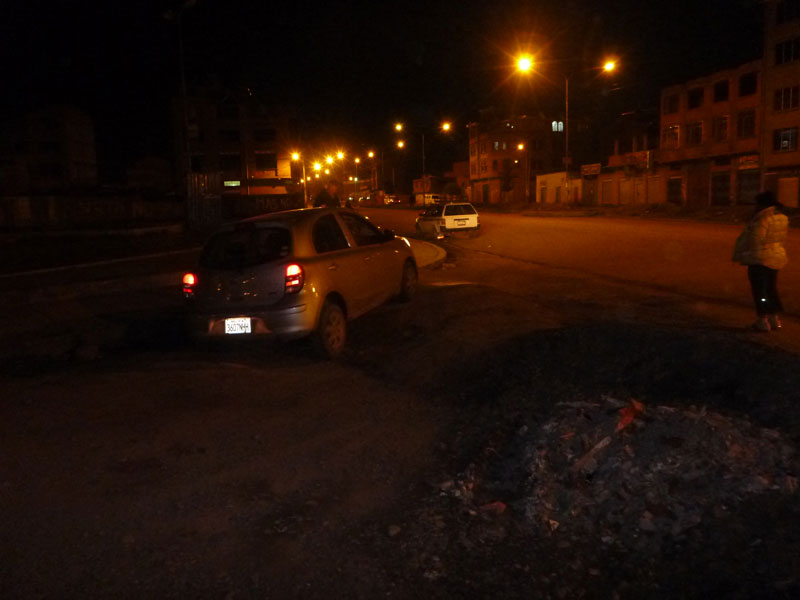
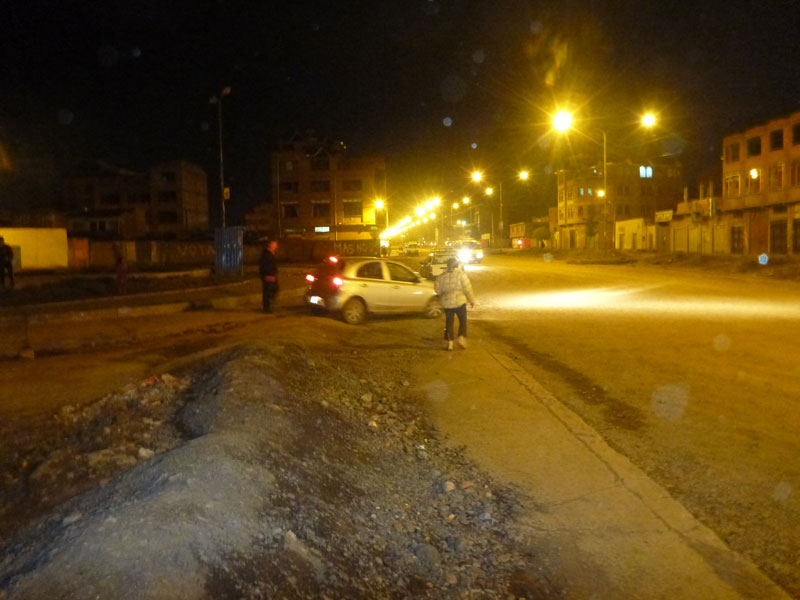
There are many streets literally shut off from the main road by large mounds of dirt and barricades. If you do not know precisely what streets are open to cross the city or own a 4 wheel drive vehicle, getting from one side of town to the other is nothing short of an adventure straight out of one of the apocalypse movies. Needless to say, for a short while, we were lost - very lost. As you can see we barely got the car over one of these earthen mounds. But Wendy and Ruben were quite the navigation team talking to various people along the streets to eventually find our way back to the main highway and back to La Paz.
Thursday 4/21
 We flew from La Paz, Bolivia to Santa Curse, Bolivia on a Airbus 319 then on to Lima, Peru on the same plane - then to São Palo, Brazil on a Boeing 767 - then to Belo Horizonte, Brazil on a Airbus 321. All flights were good. Frank arranged window sheets for both of us and we were able to get some needed rest during the flights.
Belo Horizonte, Brazil
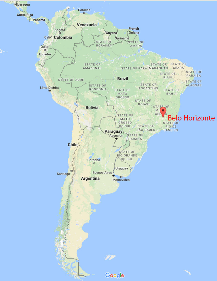 Belo Horizonte means Beautiful Horizon and is pronounced in Portuguese as Belorizot. It is the sixth largest city in Brazil, the thirteenth largest city in South America, and the eighteenth largest city in the Americas. Belo Horizonte is ranked as the third most populous metropolitan area in Brazil and the seventeenth most populous in the Americas. Belo Horizonte is the capital of the state of Minas Gerais, Brazil's second most populous state. It is the first planned modern city in Brazil. The region was first settled in the early 18th century, but the city as it is known today was planned and constructed in the 1890s, in order to replace Ouro Preto as the capital of Minas Gerais.
When we got to Belo Horizonte it was in the evening. Frank had booked us a room at the Holiday Inn.
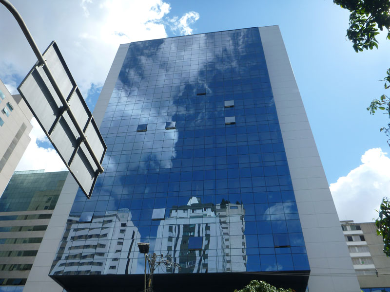 This hotel turned out to be awesome - a great place with a very reasonable price. We were hungry and needed food and bottled water. The desk person at the hotel (who spoke english) sent us down the street to a mall for both. When we got to the mall Frank and I realized that Portuguese was the language and everything at the mall was way
 over priced. I got a little worried - well maybe a lot worried. I think Frank was as well but he wasn't showing it. Very few speak English or Spanish so we are screwed language wise. In fact, outside of the hotel, we did not find anyone who spoke English or Spanish.
Fortunately, on way back to the Holiday Inn, Frank found a corner food stand where we got chicken kabobs, rum and coke, and beers all for around $10.
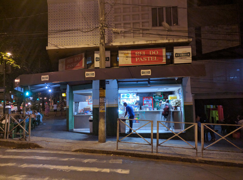
While we were sitting at one of the outdoor tables enjoying our chicken and beer a motorcyclist pulled into the motorcycle parking area just next to our table. I moved my chair to give him more room to pull in and park. He took off his helmet and said "thank you" - in english! I asked him if he spoke english and - wouldn't you know it - he is an english teacher and speaks english and Portuguese.
His name is Lucas and we befriended him. He agreed to show us around - but more importantly - be our interpreter.
Friday 4/22. We were able to sleep late - well - until just before 10 AM so we could make the free breakfast the Holiday Inn offers its guests. It is a awesome breakfast where they serve several kinds of cheese pastries. All day the electricity in the room was on and off because of some construction going on so we just rested up all day. Frank reserved a rental car for what turned out to be a great price at a local car rental establishment within walking distance of the hotel. As always, I think the cute girl at the rental car counter had a crush on Frank. That afternoon, by accident, we met a taxi driver in front of the hotel who spoke some English and Spanish. He took us all around town looking for some jewelry stores but none of them were still in business. He showed us where the museum's are in the center of town. He took us to the money exchange down town and Frank exchanged more money. He had a device for holding a cell phone in the air conditioning output duct of a car. Frank liked it and gave him some money to get him one. He actually bought one and gave it to Frank a couple of days later before we left Brazil.
 Belo Horizonte is a modern city similar to any city in the USA.
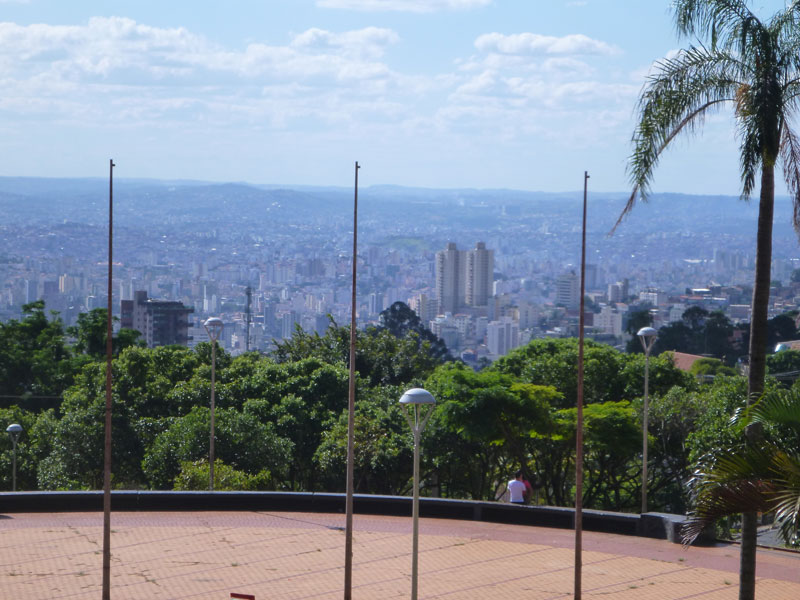
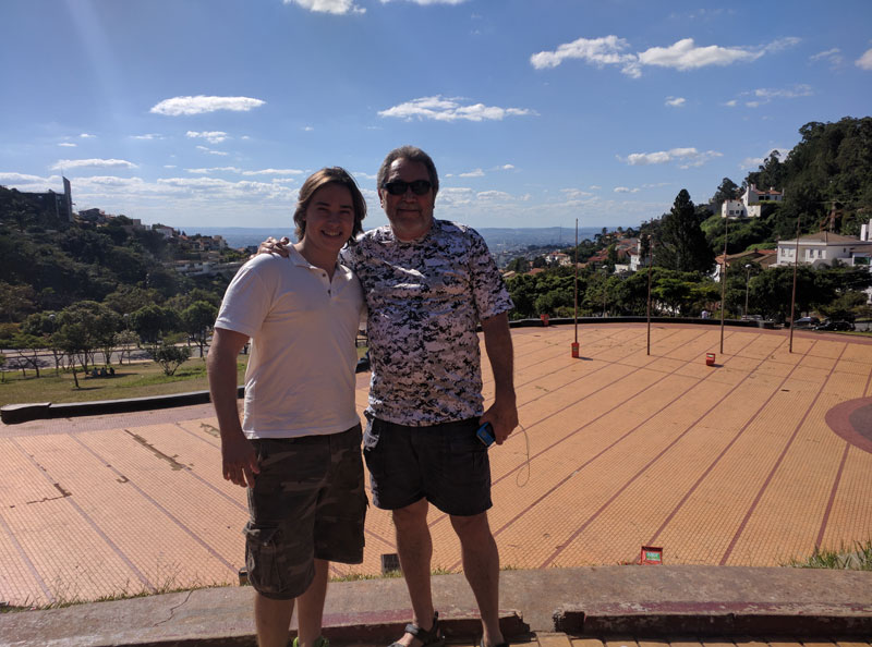
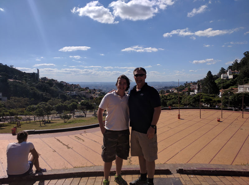
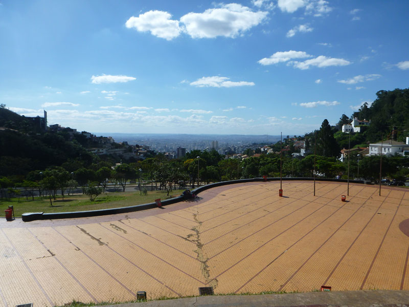 Lucas took us up to a park near the top of a hill in the center of Belo Horizonte that has wonderful views of the city.
Saturday 4/23 - Frank picked up the rental car early in the morning. We had another great breakfast at the hotel. We paid extra for Lucas to join us. All 3 of us left for the city of Ouro Preto (Black Gold) - at 11:30 AM. Ouro Preto is maybe a 2 hour drive from Belo Horizonte.
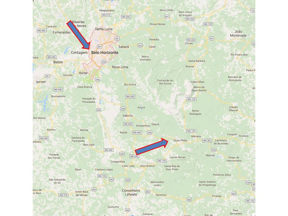 Ouro Preto is a city in the state of Minas Gerais, Brazil. It is a center of Brazilian history. While Americans go to Philadelphia and Washington, D.C. to see their history, Brazilians go to Ouro Preto. It is a former colonial mining town located in the Serra do Espinhaço mountains and designated a World Heritage Site by UNESCO because of its outstanding Baroque architecture. Artists and the elite from Europe came to Ouro Preto, fostering Brazilian Baroque and Rococo art to develop here. The town’s many churches are what it’s most famous for, especially those with the work of Brazil’s most famous artist, Antonio Francisco Lisboa (Aleijadinho). Ouro Preto is located in one of the main areas of the Brazilian gold rush and was the center of what was then (1690s) the largest gold discovery in the western hemisphere. The town developed in the early 1700s as a result of the wealth from this gold rush. Officially, 800 tons of gold were sent to Portugal in the XVIII century. Other gold circulated illegally, and still other gold remained in the colony to adorn churches and for other uses. In the 18th century, Ouro Preto became for a time the most populous city in the New World, with an estimated population of 80,000 in 1750. At that time, the population of New York was half that number, and the population of São Paulo was around 8,000.
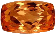
Although Ouro Preto now relies heavily on the tourism industry for part of its economy, there are important metallurgic and mining industries located in town, such as Novelis, formerly Alcan, the most important aluminum factory in the country, the Companhia Vale do Rio Doce, and others. Main economic activities are tourism, transformation industries, and mineral riches such as deposits of iron, bauxite, manganese, talc and marble. Minerals of note are: gold, hematite, dolomite, tourmaline, pyrite, muscovite, topaz and imperial topaz. Imperial topaz is a gem stone only found in Ouro Preto and exactly what we came here to purchase. Imperial topaz has a meaning and properties of making your mind stronger. It is known as a gemstone with God's wisdom inside, so it has been told that it can enhance the owner's skills.
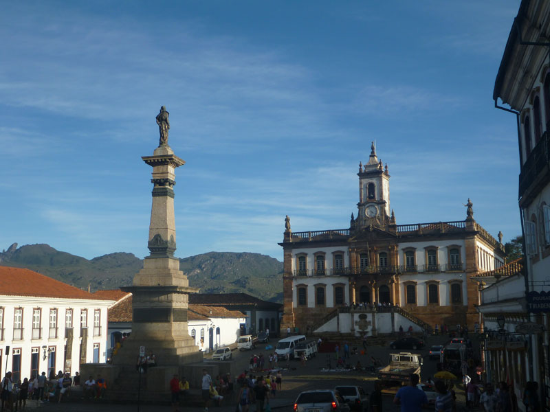

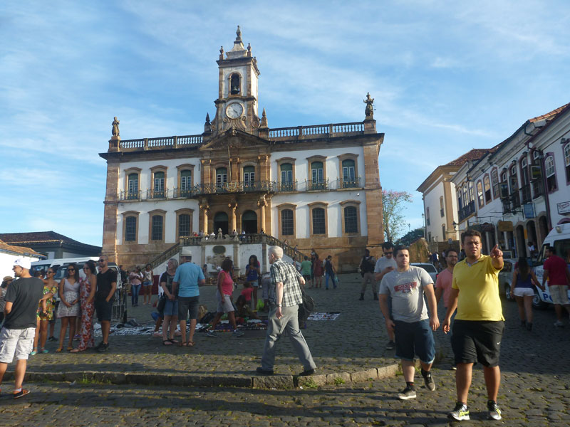 The center of the square contains a monument commemorating Tiradentes. On the other end of the square is the old university, which now houses the Museu Mineralógico Da Escola De Minas (Mineralogy Museum). Because this area has such rich mines, you can see beautiful examples of all kinds of minerals in this museum, some from the surrounding area and others collected from around the globe.
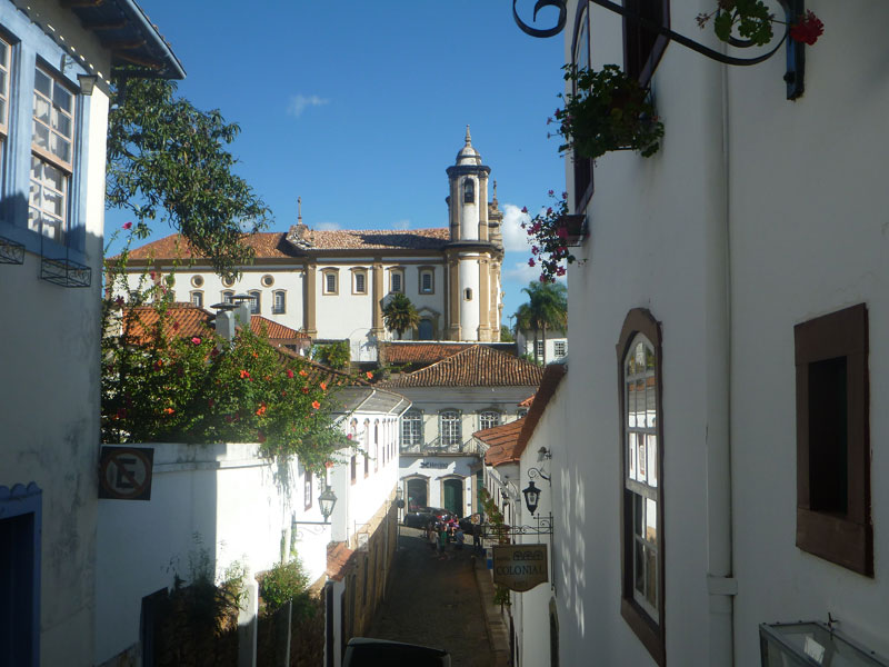
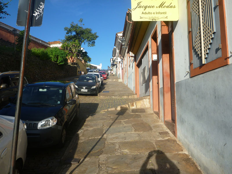 The streets of Ouro Preto are fairly steep as Ouro Preto is built in a canyon and nothing is flat.
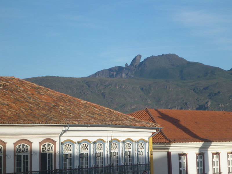 From town there is a view of the nearby mountains and the famous shape of the peak of Itacolomy, which formerly served as a handy landmark for gold seekers trying to find their way back to Ouro Preto.
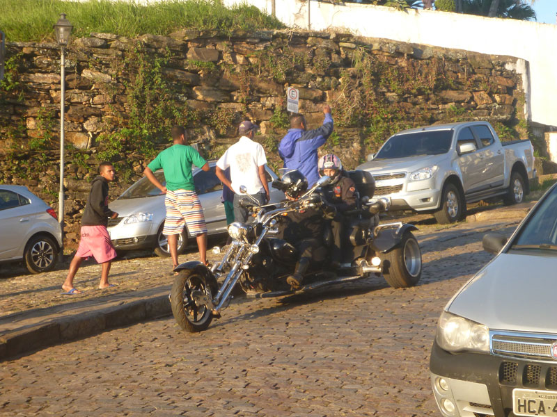 Let's not forget the trike motorcycle that is just out of place.
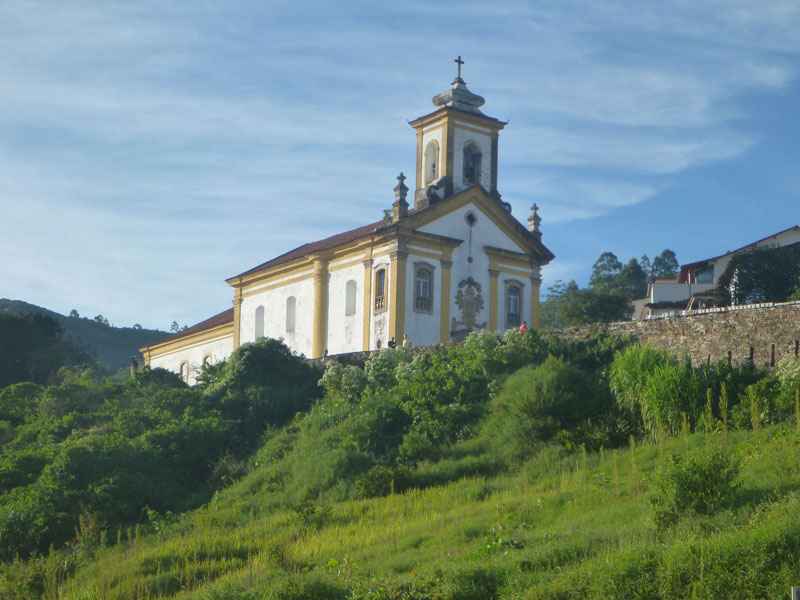 Picture of Church of St. Francis of Assisi.
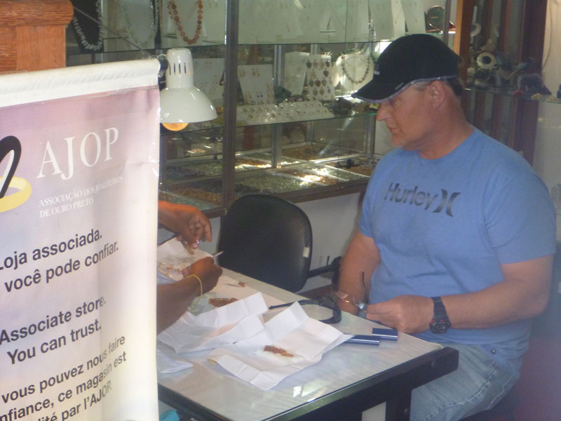

While in Ouro Preto went to several shops with Lucas interpreting along the way.
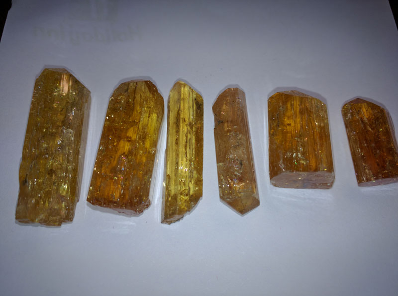
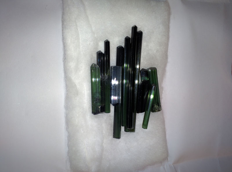 Frank purchased some imperial topaz terminated crystals. Frank also bought some terminated tourmaline pencils for his friend Tammy who owns and operates a Jewelry store in California USA.
 We went to a couple of topaz mines but could not find the owners.

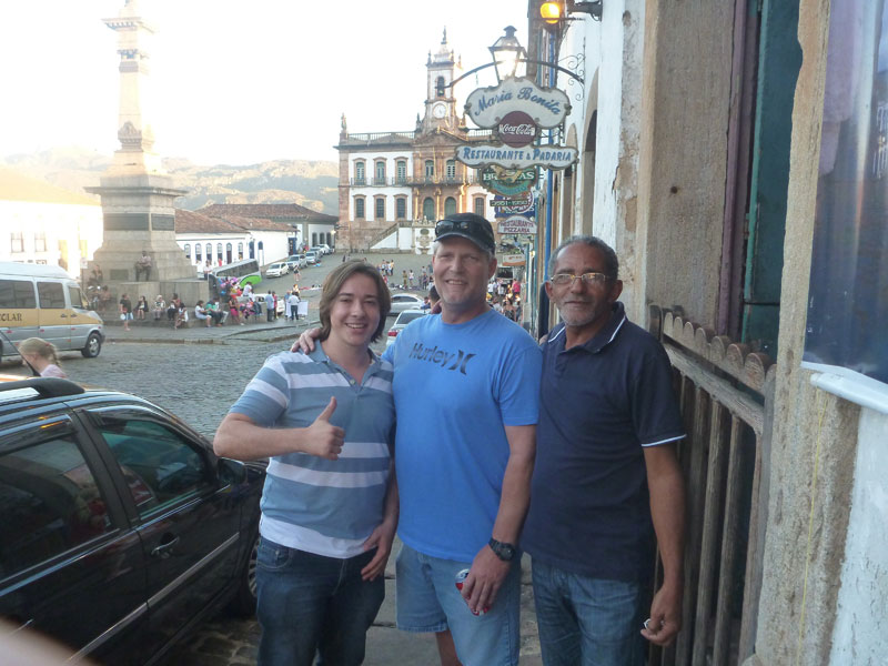
We visited several shops. They were impressive and good places to visit.
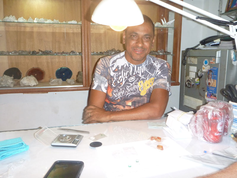
Moses, the proprietor of this small shop on one of the small side streets was very helpful.
After returning to Belo in the late afternoon we had dinner at the little outside cafe we had grown so fond of down the street from the hotel. We decided to go back to Ouro Preto again the next day because we did not have enough time to do everything that we wanted to on our first visit.
Sunday 4/24 - On our 2nd day in Ouro Preto with Lucas, 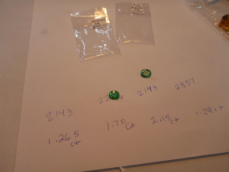
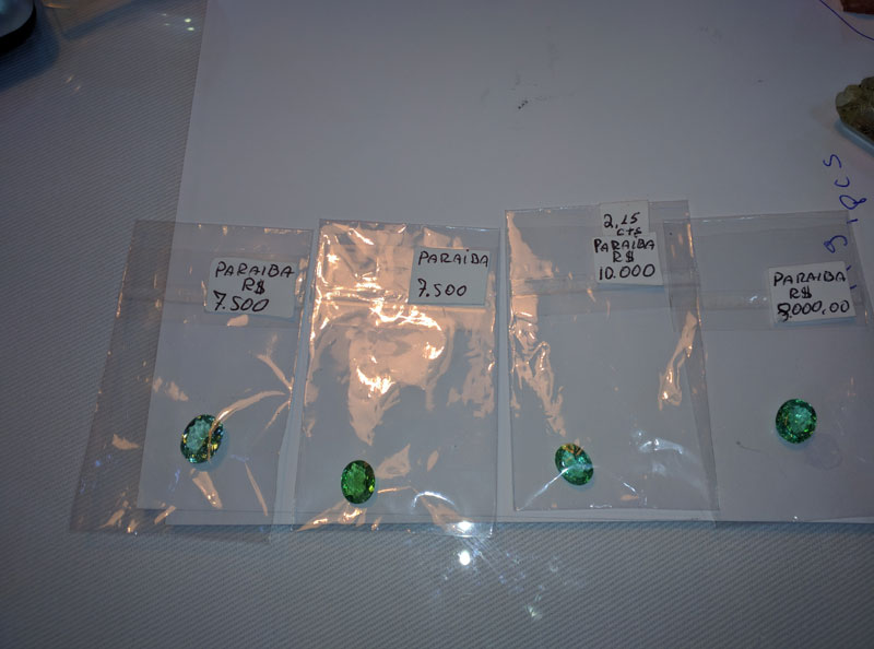 Frank negotiated with Moses over 2 Paraiba tourmaline cut stones 1 - 1ct+ and 1 was 2 ct+. The cost of both stones was $4000 worth maybe 10 to 15k in the USA if actually Paraiba but only worth $600 or so if not so we will arrange for Moses to send the stones to the GIA for testing and we will buy them if they are actually Paraiba. They must contain copper for them to actually be Paraiba but only the GIA can make that determination.
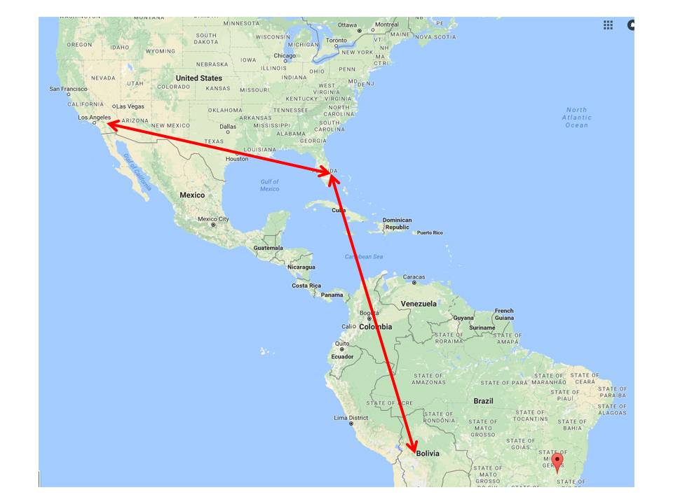
We drove back to Belo in the afternoon. Our little cafe down the street was closed so Frank and I had dinner at the hotel. It was a little expensive and just OK. We had to get to bed early because we are off to Cartagena, Colombia early Monday morning. Frank will return the rental car early in the morning, we will eat breakfast at the hotel, and take a taxi to the airport at 7:30 AM. We are supposed to arrive in Cartagena at 11:30 PM. This will be a long travel day for us all the way across Brazil. Our flight took us from the eastern coast of Brazil to the northern coast of Brazil - Belo Horizonte to São Paulo, Brazil to Bogota, Colombia to Cartagena, Colombia.
Cartagena de Indias - Colombia
Monday 4/25
 Leaving Brazil we flew from Belo Horizonte to São Paulo, Brazil on a Airbus A321 then on to Bogota, Colombia on a Boeing 767-300. For both flights there was no person in the middle seat between us. That was great. We then flew on to Cartagena on a Airbus A320 where we got upgraded from last row to over wing exit seats. These were great flights and not bad at all. At the São Palo airport, on a short layover, we ate at a Carl's Junior where the sign said in huge letters "The Taste Of California". A flashback of home but not as good as McDonalds - I think.
When we arrived in Cartagena around midnight, Juan Carlos and Jose were at the airport to meet us. It was awesome that they went out of their way to came to get us. It was great seeing them again. It was late in the evening and we were exhausted from a full day of travel. They packed us into Jose's car and took us to our hotel. The hotel in the old city was not good. In fact, it was pretty bad but standard for the old city as we found out. It was late and everyone was tired so we spent the night anyway. Frank was not a happy camper.
Tuesday 4/26 - "The shower head fell off in my hand". Well that is all I heard as Frank stormed out of the room. "I'm going to find us another place. I'll be back." The beds were uncomfortable and the room smelled. Frank went to find another room. Somehow he ended up running into Jose. Apparently Jose talked to Alfredo and Alfredo offered us accommodations at his apartment in the old city not too far from where we were.
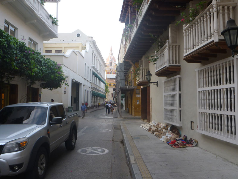 Located in the heart of the old city adjacent to everything the old city has to offer is the Diaz luxurious apartment.
 This place is as nice as it gets. The decorator had a flare for the elegant but the space is useful and comfortable.
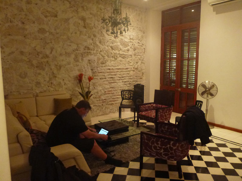
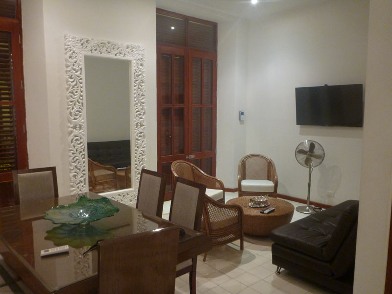 Presidential is all I can say. Several bedrooms and baths with a kitchen and living room. Clean, comfortable, and very nice - a palace to say the least.
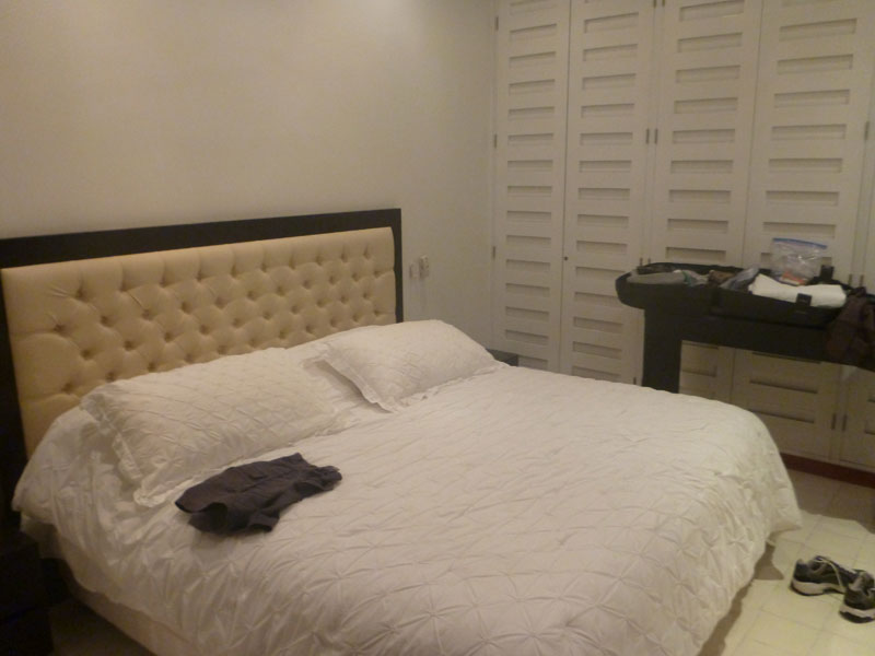
 Frank and I were more than appreciative. It was the nicest accommodations we had on the entire trip.
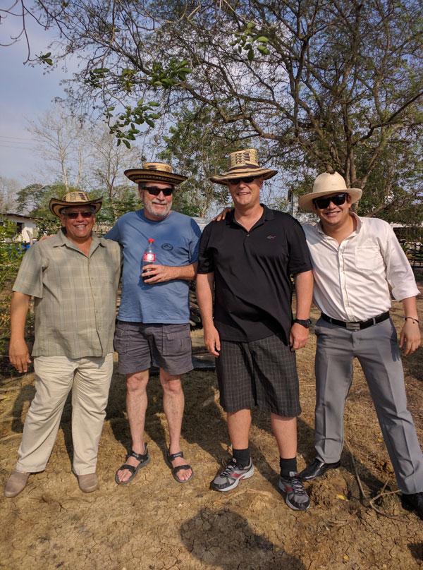 Alfredo took us to his ranch where he has 25 employees, cows, horses, 2 huge ponds, many mango and fruit trees, and a house he is refurbishing. Pictured to the right - Alfredo, Mark, Frank, and Juan Carlos.
 This area will be what they call a pond - looks like a lake to me - as soon as the rains return. Cartagena has been in a several year drought but the rain will return eventually and actually did in late 2016 and early 2017.
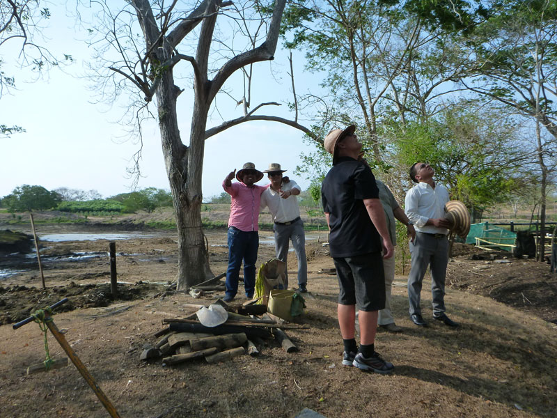
Jose and Juan Carlos goofing around in front of the house that is being remodeled.

Alfredo has several corrals with many cattle. Ricardo, Alfredo's brother, is a veterinarian and helps keep the animals healthy and happy.
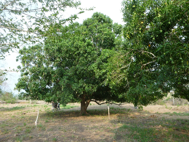
Beautiful huge mango trees, loaded with fruit, traverse the property.
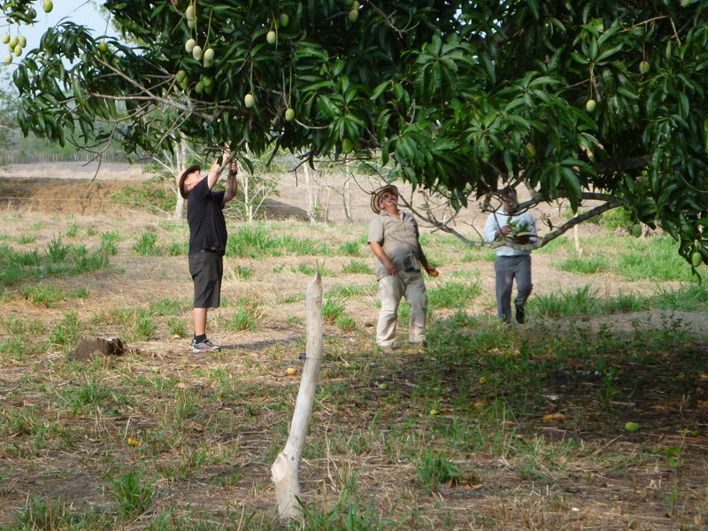 Alfredo and Frank are poking ripe mangos with long sticks trying to get them to fall out of the tree. If you like mangos, this is great fun and really good eating. However, they are a little stringy for me.
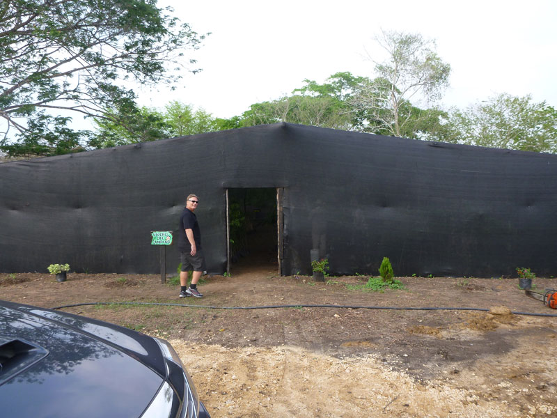
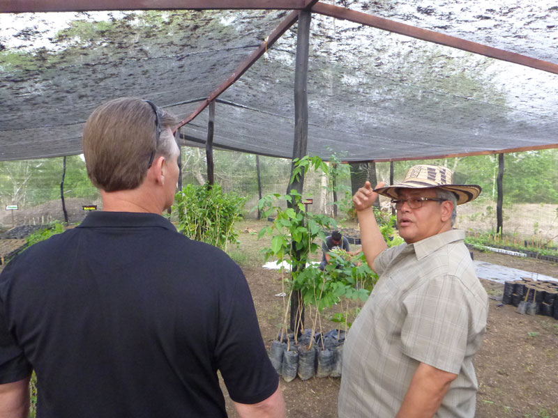
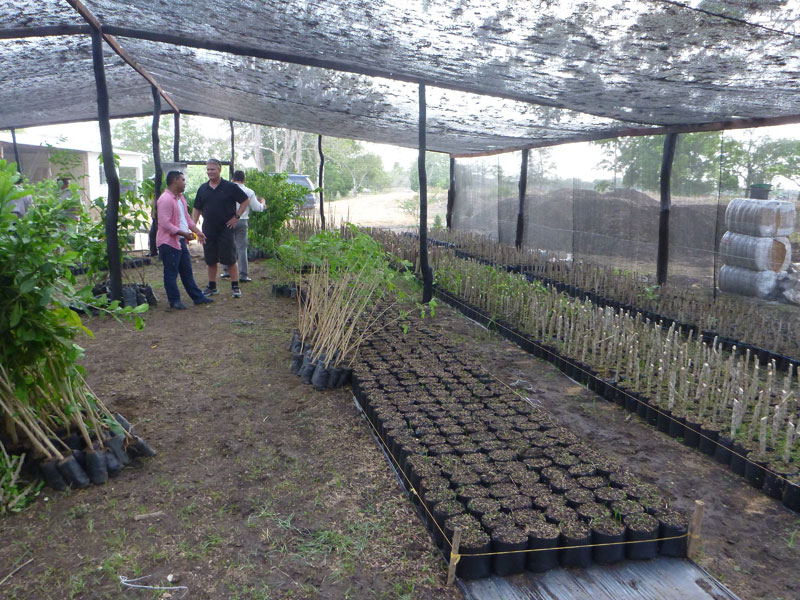 This is a green house where Alfredo is cultivating many types of trees and plants to be planted in and around his ranch. This is quite the operation.
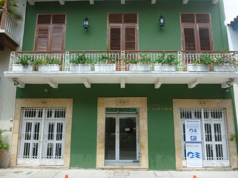
 We also visited the 2 new emerald stores in the old city with Jose and Juan Carlos. Alfredo just expanded from his store, emerald museum, and jewelry design and fabrication center in Bocagrande adding 2 new stores inside the walls of the old city. He has to be the largest emerald dealer in Cartagena.
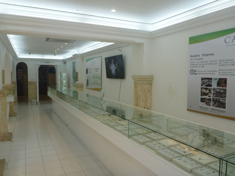
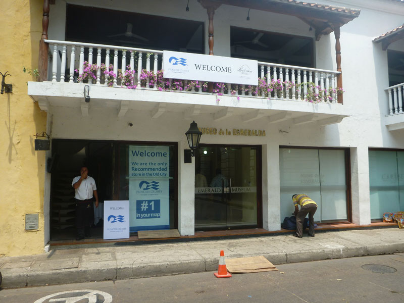
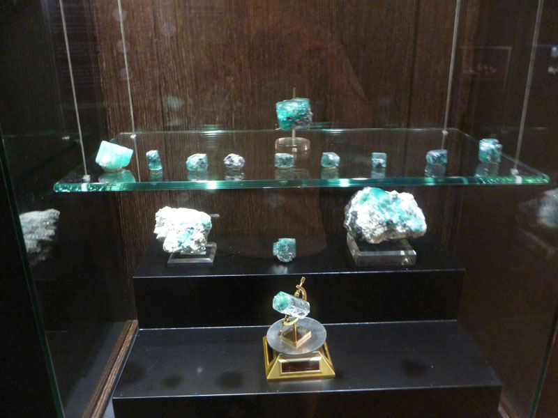
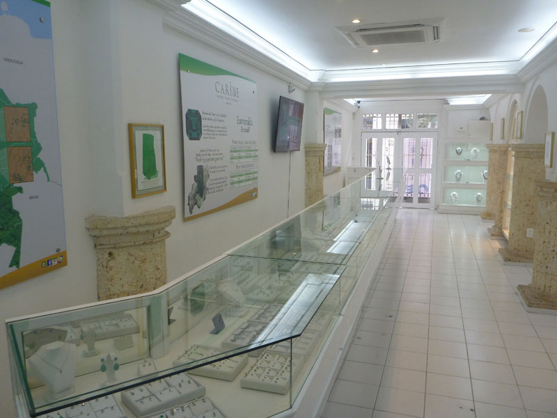 These are beautifully designed stores each having their own - smaller than Bocagrande - but still impressive emerald museums.
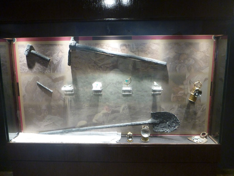 When the visitors from the cruise ships arrive at the store, they are escorted through the emerald museum by a tour guide where they learn some of the history of emerald mining in Colombia.
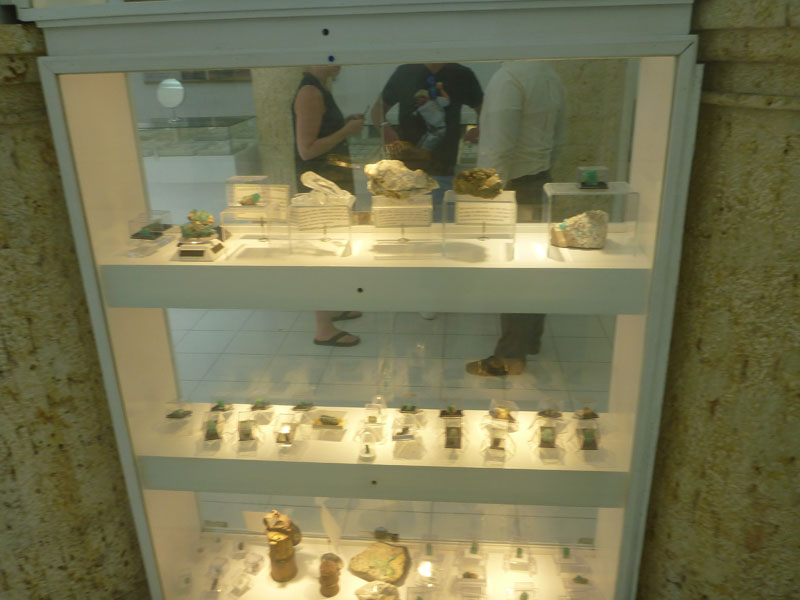
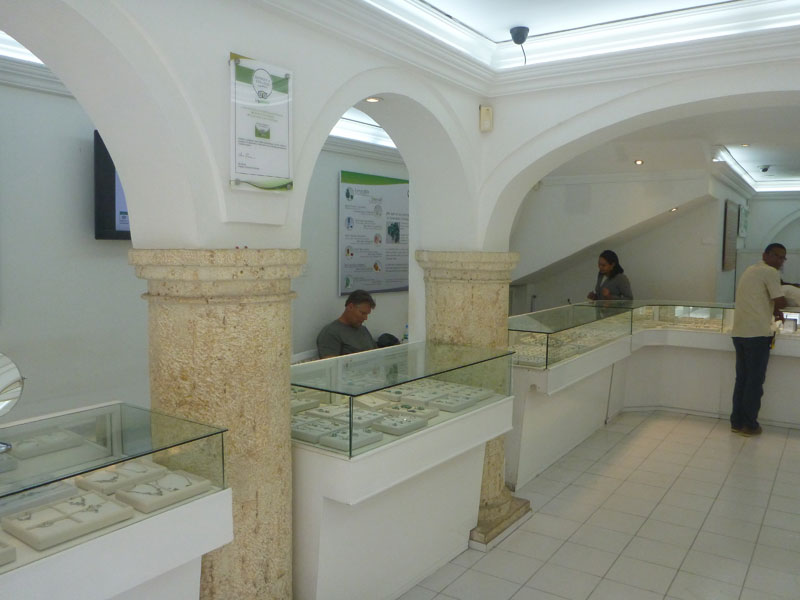
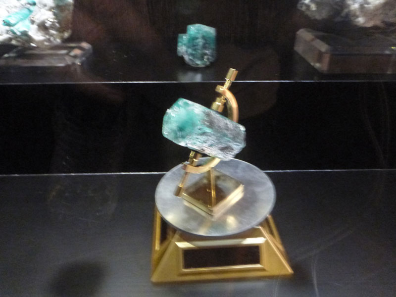
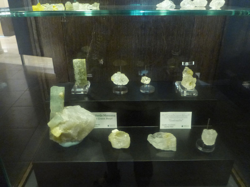 On display at the museum are some of the most impressive emeralds I have ever seen with most being museum quality specimens of extreme rarity and value.
The Bocagrande museum, in addition to having a fabulous emerald display, boasts the largest emerald matrix to ever have been discovered in Colombia.
 Alfredo and his brothers have done an extraordinary job in the creation of these stores, museums, and training center's.
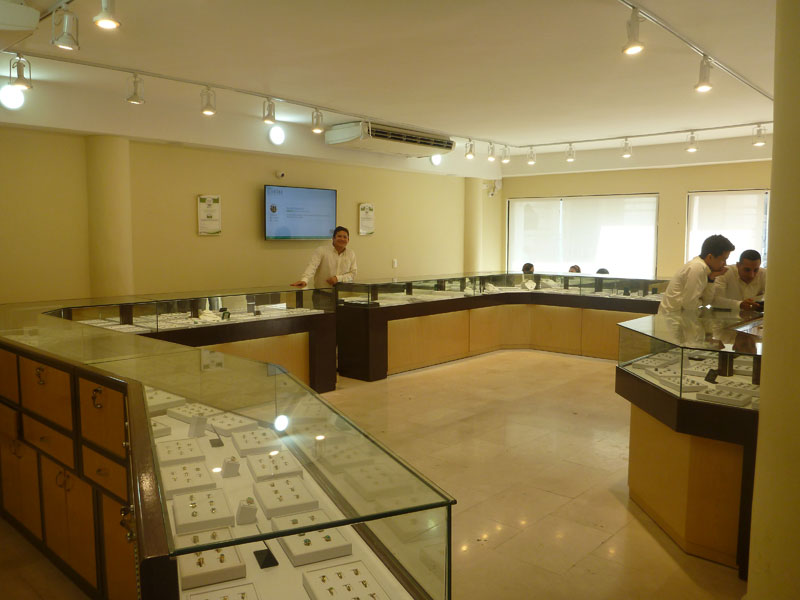
 After walking through the museum, customers can then browse the display cases of beautiful emerald jewelry available for purchase.
We had dinner with Alfredo, Eduardo, Ricardo, and their wives at a restaurant next door to where we are staying. I had beef stroganoff and it was delicious. Thank you Alfredo for a wonderful dinner. Thank you Alfredo, Eduardo, and Ricardo for your tremendous hospitality.
The last cruise ship of the season arrived in Cartagena today. The cruise ships will not return until October. Frank and I observed how Alfredo's employees sell emeralds to the tourists who come through their museum and store. I went on the tour and talked to many of the tourists soliciting their feedback. Frank and I gave Alfredo our input as to our observations with the hope it will help Alfredo strengthen and expand his business. Alfredo probably does not need our input as he obviously knows his business far better then we do but I think a third party perspective may have given Alfredo some fresh ideas.
Wednesday 4/27 - Alfredo took us to see the jewelry teaching center in Bocagrande which is in the same area as the Caribe Jewelry emerald store and museum. As we will soon discover, this center is multipurpose. Our first stop was to attended the end of a jewelry making class that is designed specifically for cruise ship guests. The students (cruise guests) are picked up at the cruise ship and taken to the teaching center. For a small fee, in an air conditioned class room setting, they get to design and make some jewelry under the guidance of a teacher proficient in the manufacture of that particular type of jewelry. I was able to speak to several of the participants about their experience. They were mostly husband and wife couples from the USA and they were thrilled to have been able to actually make some simple jewelry under the guidance of teachers who are experts at their craft. This is all accomplished in a air conditioned class room setting with english speaking specialists. Perfect!
We were then taken into the heart of the training center. We met several of the teachers and visited classes that were in session.

People were obviously very happy learning how to work with precious metals and design and create jewelry.
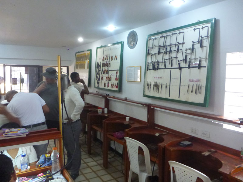 All of the tools and materials needed to accomplish the training are supplied by the teaching center.
 Many of the students were eager to show off what they had made.
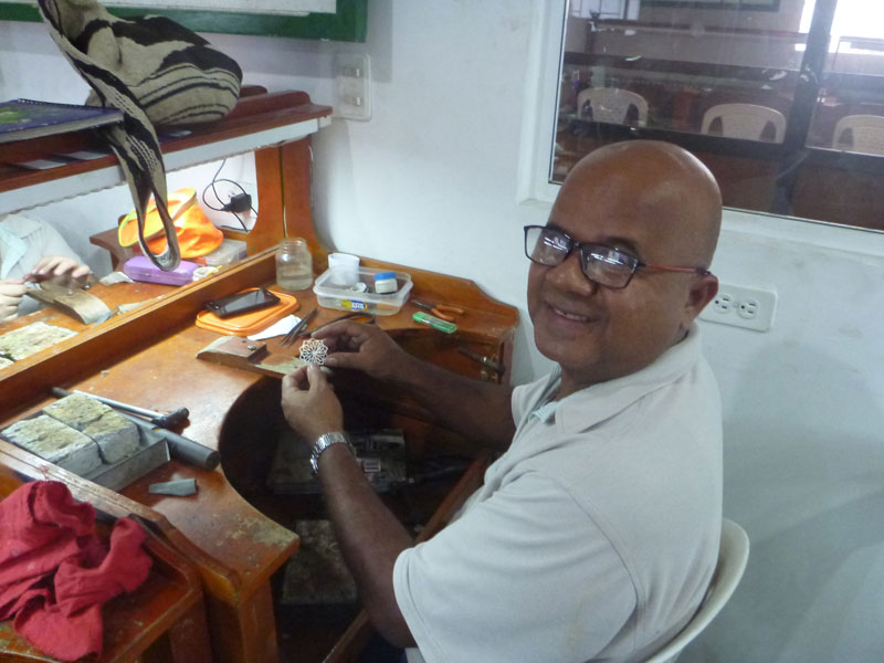
This was an awesome experience. This school is a service to the Colombian people where opportunities are few. Alfredo is providing people with the opportunity to learn a skill, and if they become proficient, obtain a job with his company after graduation.
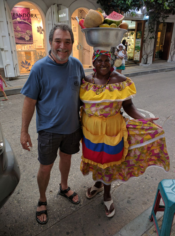
Pictured left, I am posing with a fruit vendor outside one of the emerald stores. Frank actually paid so he could take this picture.
Later we went to dinner with Juan Carlos and had pizza at one place - Hawaiian for me. Even later in the evening we had a hamburger at another place - 2 for one. This place had music and a disk jockey. All in all the atmosphere and food was pretty good.
In the plaza, when we were walking back to the apartment, a hooker with big boobs "boobed" me in the back and took off laughing and smiling. Everyone got a good laugh including some of her friends standing near by, and especially Frank and Juan Carlos.
It was very hot for our stay - 94 degrees with 80+ humidity during the day and only a little cooler at night. Really uncomfortable to do anything that did not include air conditioning. But I think that is the weather in Cartagena all the time. At least it has been every time I have been here. As long as the wind is blowing off of the Caribbean, there are literally no bugs and it is a little cooler. But, when the wind stops blowing, watch out. It gets even hotter and the bugs come out - I'm told. Fortunately the wind has been blowing every time I have been there.
Thursday 4/28 - Juan Carlos and Jose picked Frank and I up at the apartment at 6:30 AM and took us to the airport. Thank you, again, to the Diaz brothers for their hospitality and friendship. Our stay in Cartagena was nothing short of awesome.
 We flew from Cartagena to Bogota on a Airbus A 320 then to Lima, Peru on a Airbus A319 where there was a C17 US military aircraft, that I used to work on, parked at the military parking area at the Lima airport.
 How cool was that! Then on to Cusco on a Airbus A319. We ate at McDonald's in Bogota. The Egg Mc Muffin sucked. Fortunately all the flights were good. Frank had become proficient at rearranging the seating to our advantage and he did just that for the last flight even though it was packed.
Cusco - Peru
We got to Cusco at night. Frank found a taxi driver who spoke English pretty easily. While taking us to our hotel he negotiated a $20 city tour for the next day. He wants $100 to take us to the city of Ollantaytambo in a private car including a tour of the Sacred Valley. The pitch didn't sound too bad.
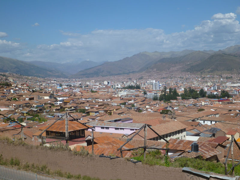
Cusco, a city that sits at an altitute of 11,150 feet in the Peruvian Andes, was once capital of the Inca Empire, and is now known for its archaeological remains and Spanish colonial architecture. Plaza de Armas is the central square in the old city, with arcades, carved wooden balconies, pre-Incan and Incan wall ruins. The baroque Santo Domingo Convent was built on top of the Incan Temple of the Sun (Qoricancha), and has archaeological remains of pre-Inca and Inca stonework.
The hotel Frank booked us was awesome. 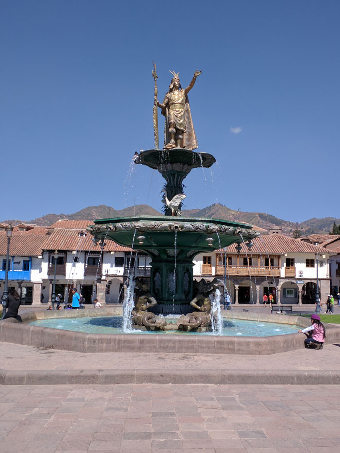
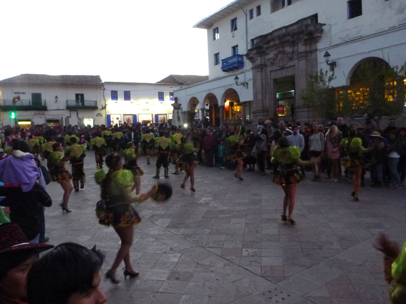
We walked to city center square - Plaza de Armas - and took some pictures. It was a little cool but not cold. All the locals we saw were wearing coats but not Frank and I.
This is a very clean city. Many speak English. All of the traffic police are women and there is one at every major intersection.
We went back to hotel to get some sleep. This is a place Beth would like. You could take your wife and family here without too many concerns.
Friday 4/29 - We went to the free breakfast at the hotel. It was very good. 
The only problem was that Frank ate literally all of the chocolate cake. 3 helpings. I only got one tinny little piece and I had to fight him for that!
The taxi driver who brought us from the airport the previous night had given us prices to take us to the city of Ollantaytambo. The Cusco city tour was supposed to be $20 and the ride to Ollantaytambo with a guided tour through the Sacred Valley was $100. When he arrived to take us on the city tour he wanted to sit down and talk. This was weird. We were ready to get into a vehicle and go and this guy wants to sit down somewhere and talk. Frank and I were already uneasy. It turns out it was $20 each and we had to pay $45 each for the tickets to all the places and it was on a tour bus. The ride to Ollantaytambo was now $150. Anyway we figured out fairly quickly he was a hustler and it didn't take long for Frank to send him on his way. We had already found out from the front desk that we could get a taxi from the hotel in Cusco to Ollantaytambo for 90 sol or about $30. 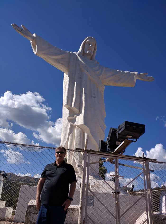

So we had the front desk call for a taxi and off we went to see Cristo Blanco at the top of the hill above Cusco.
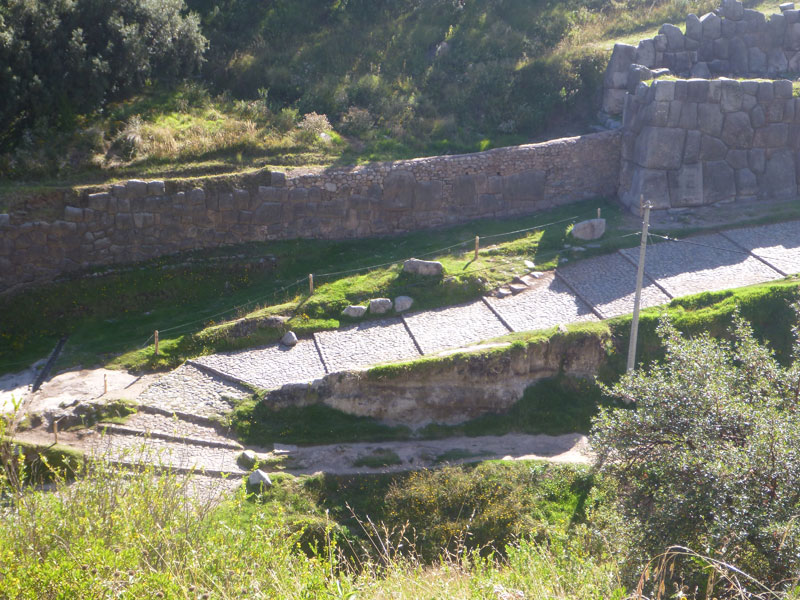
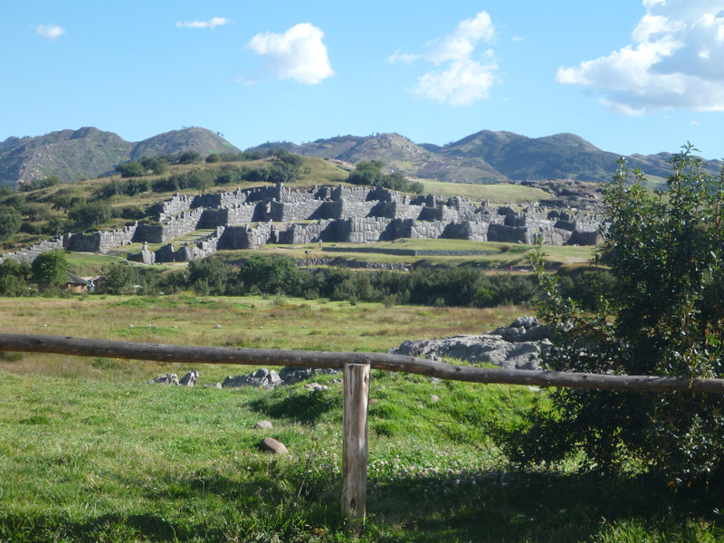 While at Cristo Blanco our taxi driver showed us the back side of Sacsayhuaman.
During the city tour Frank negotiated our ride to the city of Ollantaytambo tomorrow and a ride back in a couple of days - 120 sol.

 Our taxi driver - Oscar - was happy to show us all the sights around town and he even took us to a local dinner house where we bought him dinner. They had traditional dancing at this restaurant where local dancers in costume would come and select people eating to come and dance with them on stage.
A great day that cost us 50 sol + dinner - just under $20.
Follow this link Cusco Ollantaytambo Aguas Calientes Machu Picchu Peru for a detailed review of Cusco, Ollantaytambo, Aguas Calientes, and Machu Picchu.
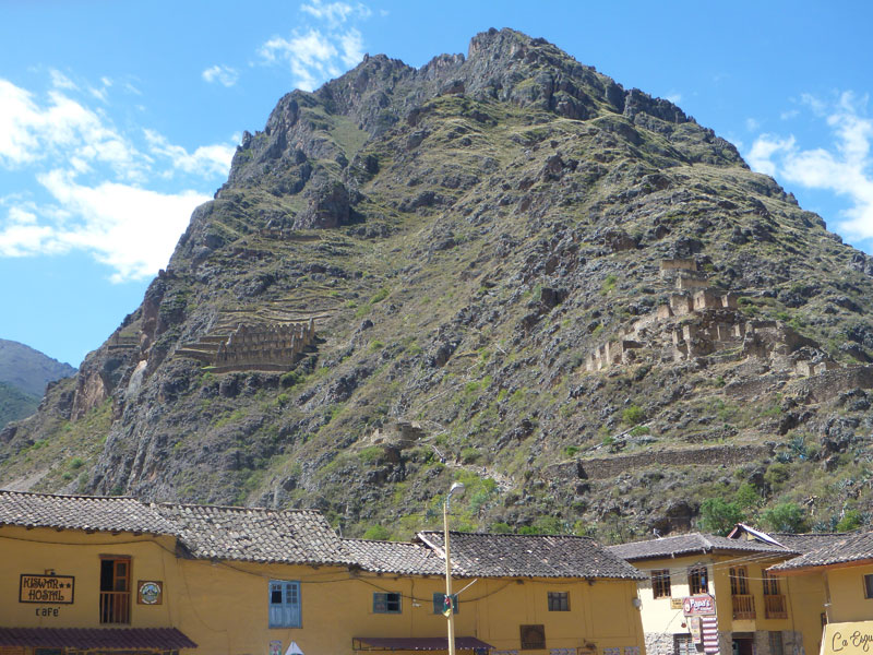
Saturday 4/30 - We had another good breakfast at the hotel and then off through the Sacred Valley to the city of Ollantaytambo with our taxi driver, Oscar.
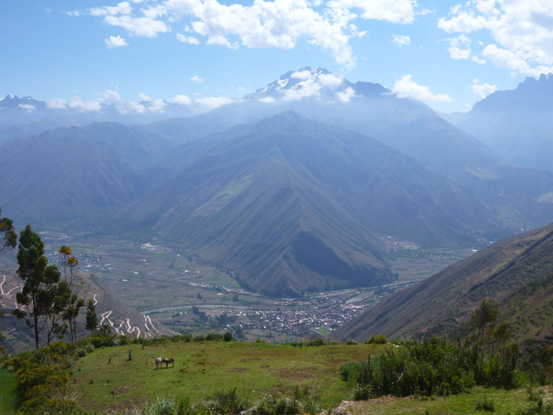
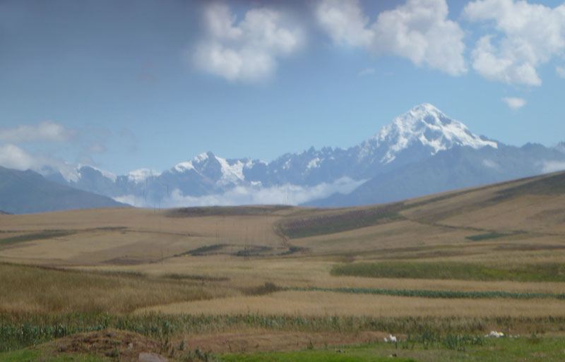
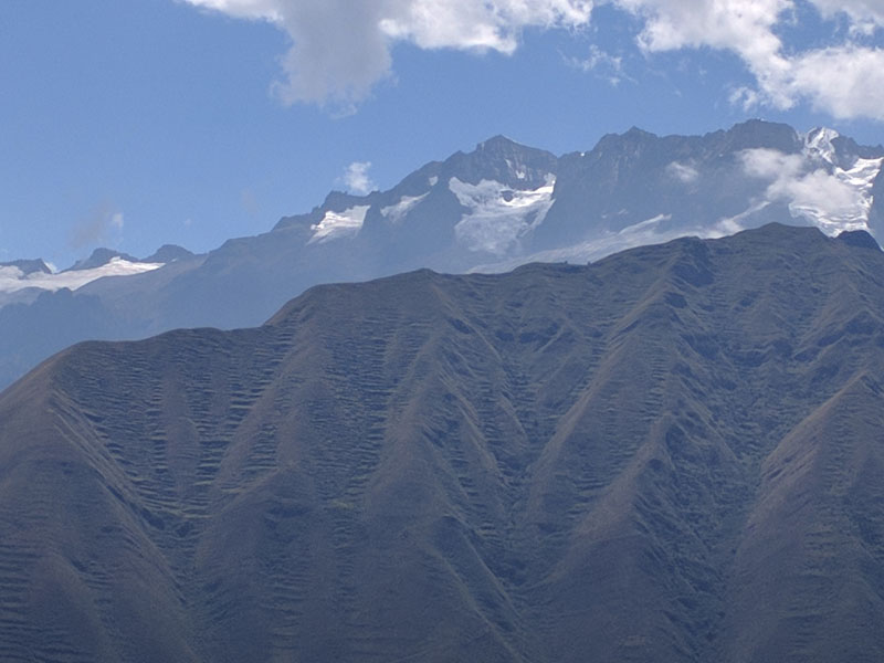
 While traversing the Sacred Valley we stopped several places along the way for pictures. This is a very scenic drive with many breathtaking vistas of high Andean mountains, some with glaciers atop them. Ruins are visible high on many hillsides throughout the Sacred Valley.
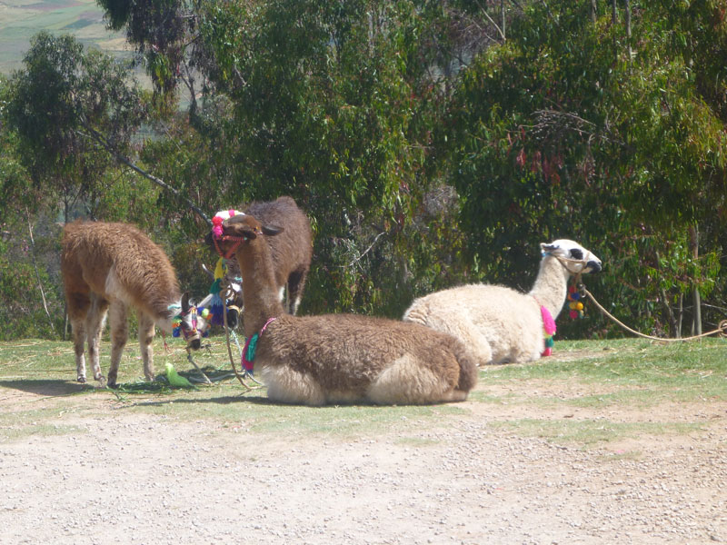
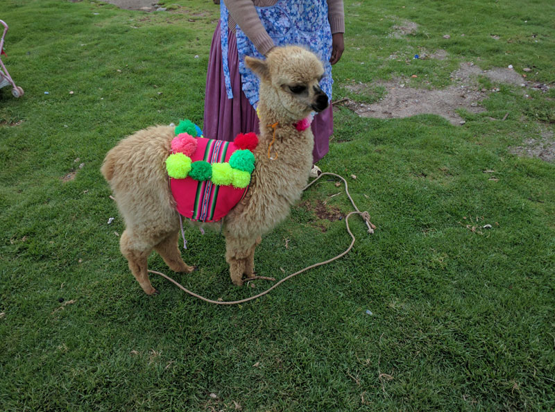
Llamas are also a common site.
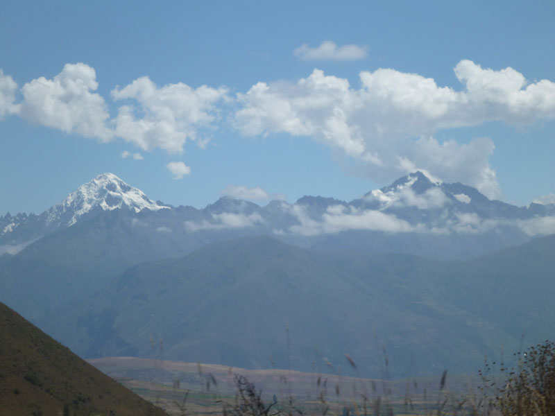 More remarkable vistas from the Sacred Valley. There are viewes like this all the way through the Sacred Valley.
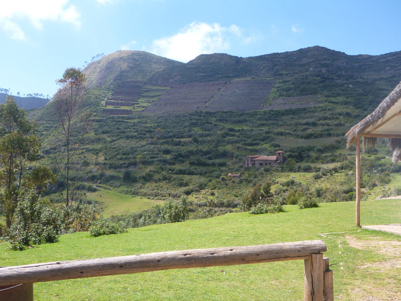
 Even here you can see the terracing of the hill sides just like in Bolivia. Except here the terracing extends up into steep and high valleys.
 We drove under the "Sleeping in the sky" glass pods where climbers use ropes to climb up to the pods and spend the night - like a hotel in the sky. Not me!
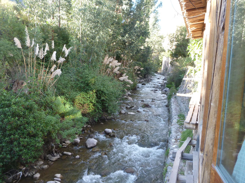
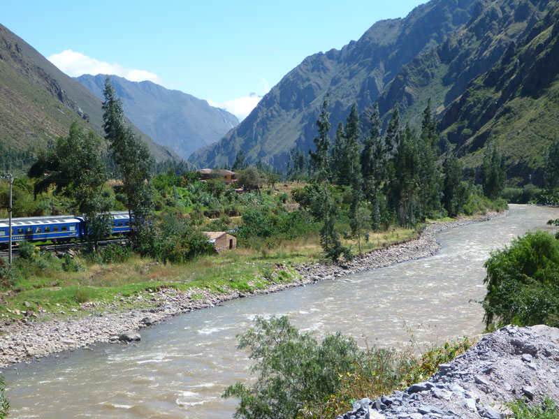 The road took us along the rail road and river that runs from Cusco to Ollantaytambo. The train can be taken from Cusco to Ollantaytambo as opposed to driving.
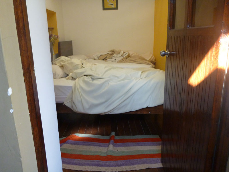 We got to our hostel. I would call it primitive and small but from what I see around me hot water is a plus. That is a picture through the front door at 2 beds pretty close to one another. A small bathroom is at the foot of the beds separated by a wall. That's it. I took this picture to show how off level the floor is.
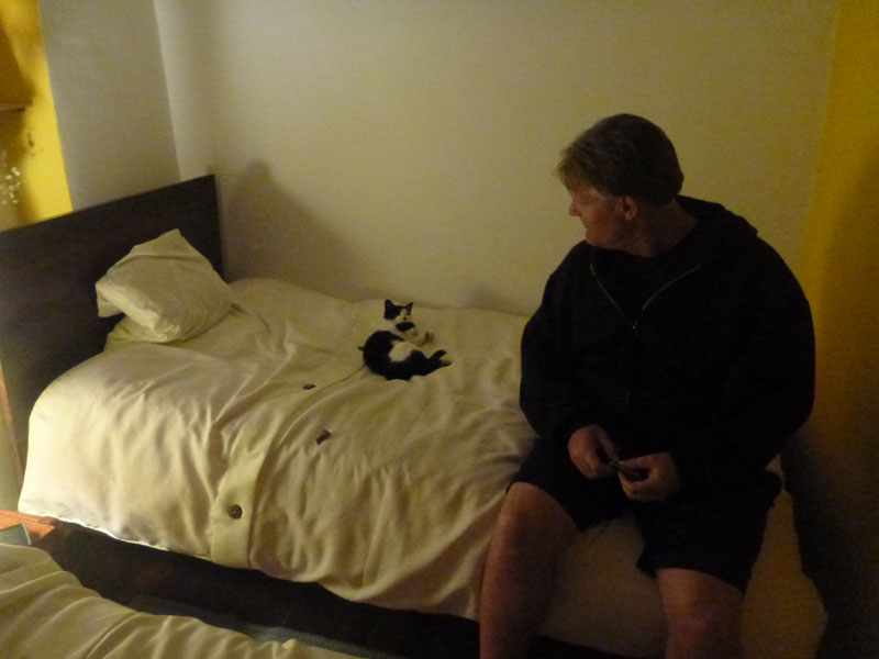
Frank made friends with a small cat who apparently sleeps in this room all of the time. She pushed the window open and was asleep on Frank's bed when we got back from dinner. The cat slept with Frank for 2 nights - all night - under the covers - and left early each morning via the barely open window.

We walked around town and down to the train station.
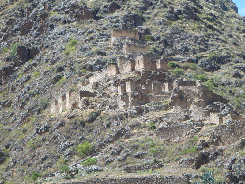


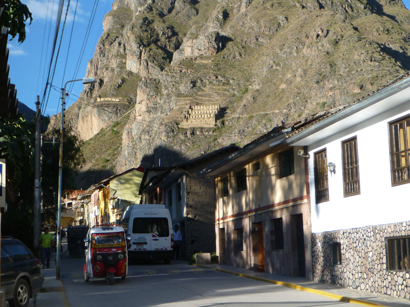
Many ruins are visible on the mountains that surround Ollantaytambo. People are actually walking long distances up very steep trails to visit these sites.
We had chicken and beef kabob from a street vendor. They were so good we had a couple more. We went back to the hostel and took a nap before dinner.
 We went to one of the restaurants on the street leading to the train station. I had a Hawaiian pizza and Frank had alpaca. What's with me and pizza's?
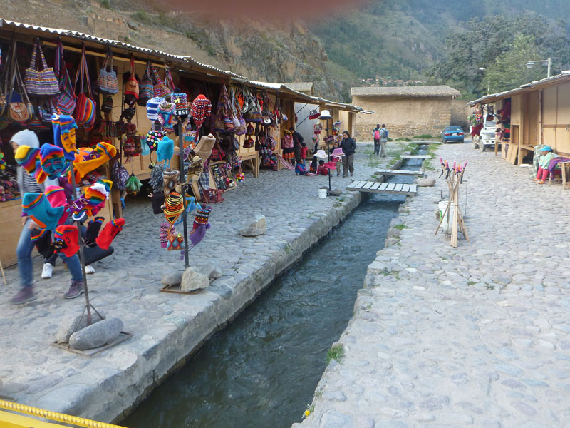 We went to the vendor area just over the bridge that crosses the river and bought Beth a really nice alpaca blanket for 120 sol. Notice the water canal running through the middle of town. These canals are all over the place and keep runoff from the mountains from flooding the city during both the wet and dry seasons. This is clean cold melt water.
 We stopped at the chocolate store on the way back to the hostel. I learned a lot about chocolate that I never would have believed. We met a couple working there that were from Northern California. They get 30 sol per day plus a room. Their last day there is tomorrow. Awesome chocolate.
Sunday 5/1 - We woke up early and had breakfast at the hotel. We are off to Machu Picchu today. We walked - down hill - to the train station.

 On the train, we sat across from a couple from Uruguay. She was a biochemist and he studied spiders for the use in insect control.


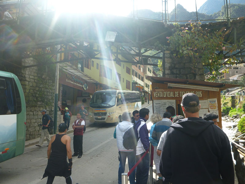 We arrived in Aguas Calientes, departed the train station, walked through the shopping area, over the bridge, down the stairs, and got in line at the ticket booth to purchase bus tickets for the ride from Aguas Calientes up to Machu Picchu. There are a few things in life you want to pay for and this one of them. Heads up - no passport no bus ride to Machu Picchu. We rode the bus up the mountain through switch back after switch back all the way to the top.
 We got off of the bus and back in line to enter the ruins.
Machu Picchu was kind of disappointing because at the entrance there were so many people.
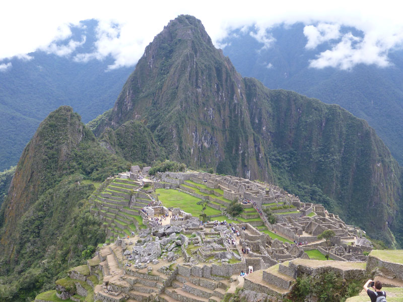
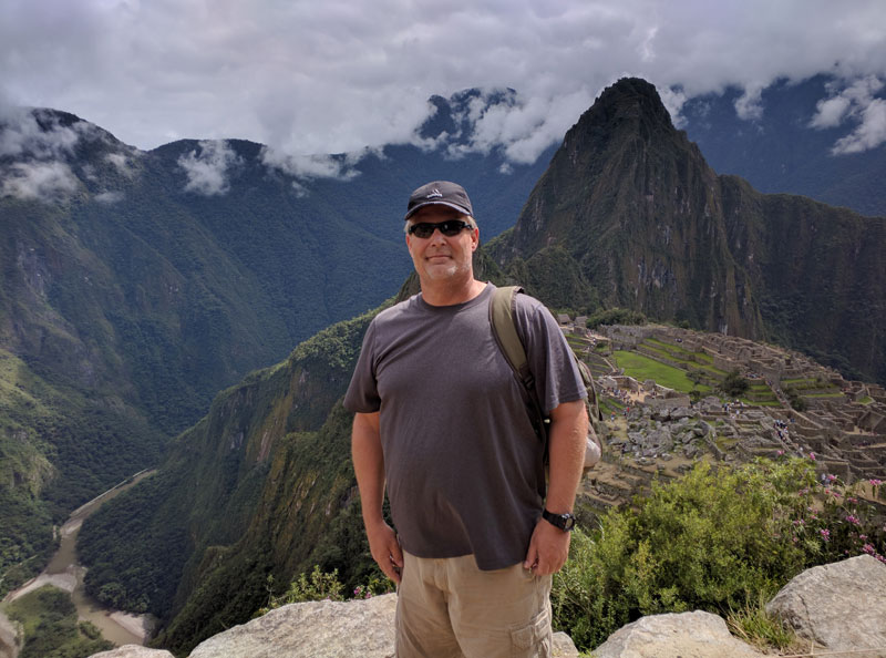 We walked up the side of the mountain via some very steep stairs for as long as we could and found ourselves near the top of the ruins where the vistas of the ruins are the best.

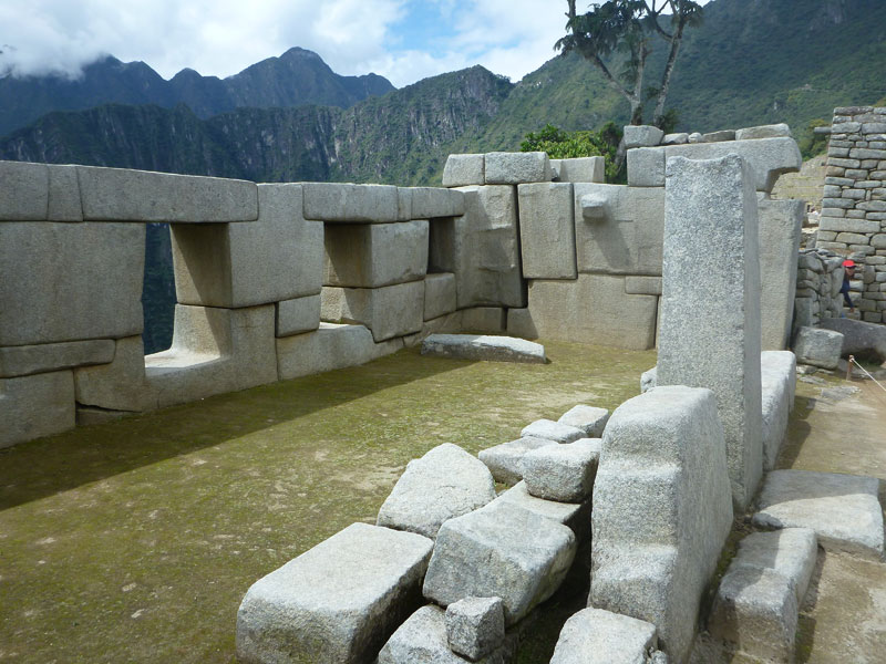 We then traveled to the center of the ruins to see the sacred areas and then out moving down hill practically the entire time. This made the longest part of the walk easy and enjoyable. We had cell phone reception the entire time. I even called Beth in the US from the ruins. We spent about 2 hours walking around the ruins and taking pictures.
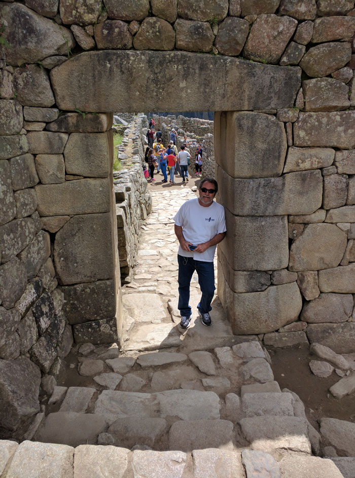
We could have stayed longer but our legs were giving out. We didn't see everything but we had seen enough.
We then got back on a bus and went down to Aguas Calientes where we had lunch.
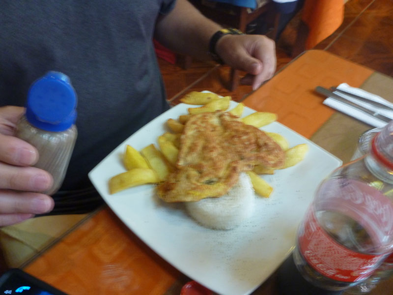
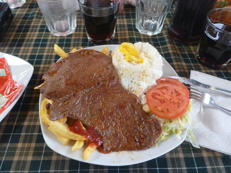
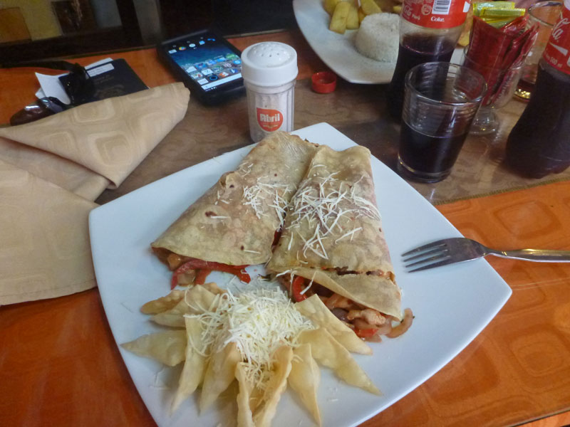 Lunch was really good. I had enchiladas (left) and Frank had chicken (right).
 I bought 3 wooden llamas with silver and stone decorated saddles for $130 US. These are pretty unique. As we traveled through Peru I saw many wood carved llamas. Through the Sacred Valley there were many with silver saddles and getting even more expensive. It was not until Aguas Calientes that I found the silver saddle with inlayed stones. I purchased them as a group and for a very good price. You should see what they get for something similar at the airport and they are not near as nice.
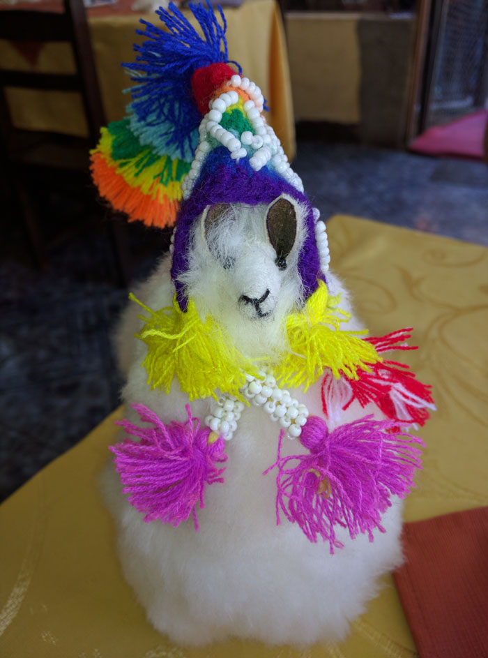
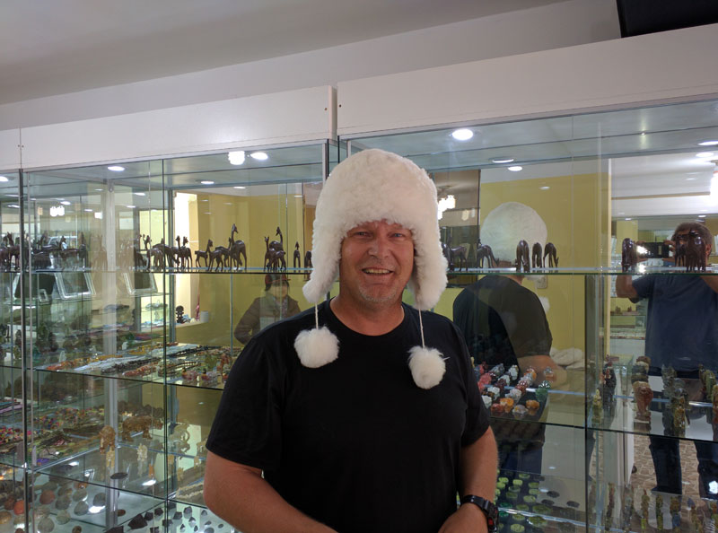 We bought Jamie a fuzzy white llama. While traversing the Sacred Valley Frank suggested the hat on the right and I actually talked him into putting it on and decided to include this picture to prove it.
We had several hours to wait for our train so we sat at a restaurant and had a coke then walked around some more and sat on a bench for a while.
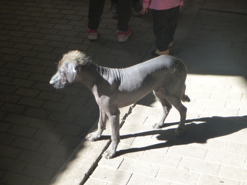
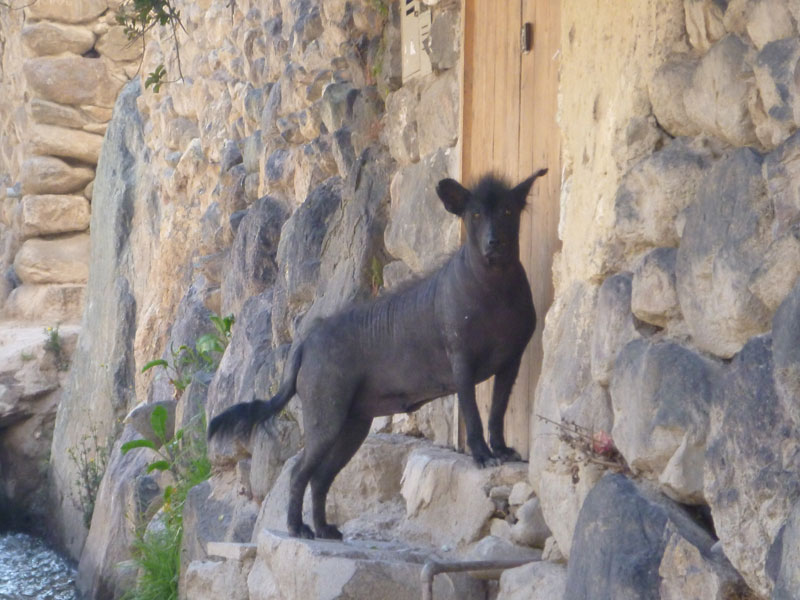 We ran into more black skinned hairless dogs. Don't be alarmed. They are actually the national dog of Peru and fairly common throughout Peru. The picture on the right is what they look like full grown. This one was living across from the hostel we were staying at and wasn't happy about being locked out.
Finally Frank had enough and went to battle with the train ticket agent - for the 3rd time. This time Frank got us on a earlier train saving us 2 hours sitting around waiting. As I recall it started off at $100 each his first attempt but now it was only an additional $20 each.
On the train back Frank sat with and talked to a couple from Poland. As usual, Frank rearranged the seating on the train for our comfort. It got dark so I got some rest. We got back to Ollantaytambo and walked from the train station to the hotel - up hill the entire way. I was huffing and puffing by the time we got to the hostel and that was with taking a half dozen breaks along the way. Frank was only slightly winded. We rested for a while then went to dinner at a place adjacent to the square. Actually, we walked to and from the train station several times during our stay. No one time was easier than the other but we both made it without too much difficulty.
 There was a band playing in the square - something to do with the end of a big bicycle race.
Frank ordered guinea pig and I had Hawaiian pizza again. Both were not very good. The guinea pig was greasy and did not have much meat and the pizza was bland - nothing like the pizza I had yesterday at the place on the river on the way to the train station.
Below are links to web pages devoted specifically to visiting Machu Picchu. The web pages are all the same with different titles. So, if you have seen one you have seen them all. The multiple listings are for the Goggle spider.
Machu Picchu Peru
Cusco Ollantaytambo Aguas Calientes Machu Picchu Peru
Guide to Machu Picchu Peru
Guide to the Citadel of Machu Picchu Peru
Machu Picchu Review
Machu Picchu
Ruins of Peru Machu Picchu
Travel to Machu Picchu
Where to stay Machu Picchu
Monday 5/2 - We woke up early - 8 AM - and had breakfast at the hotel. It was prepared by a family living at the property and it was quite good for where we were. While eating we talked to 2 Canadian girls who had been to the salt flats on the Peruvian Chilean border. They were telling us how primitive but beautiful it was. The salt flats are at 20,000 feet elevation and they had to sleep in concrete shelters on concrete slabs with a few blankets. They were sick from the altitude and cold all the time, running around the salt flats in Range Rovers. The journey didn't sound like fun but they said they had a good time but that they would not go back.
It is 9 AM and we are waiting for Oscar to come to pick us up at 10 to take us back to Cusco. We are taking a different route back to Cusco through the northern part of the Sacred Valley.
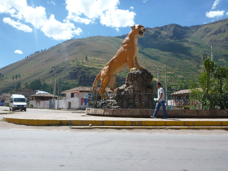
 There wasn't much to see except Guinea pig on a stick and the puma place where they actually have pumas (mountain lions). They actually have a huge statue of a puma in the center of town.
When we arrived in Cusco we took our luggage to the same hotel we had stayed in a few days before.
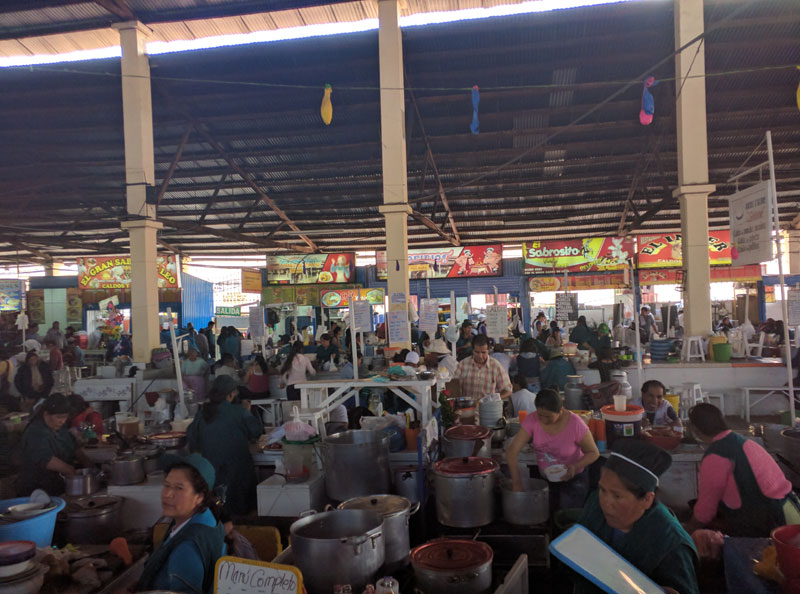
Oscar parked his car and then took us down the street to a local place - the San Pedro market - where they had food concessions and places to eat with bread and fruit and coffee and all combined with booths that were selling all kinds of gift items.
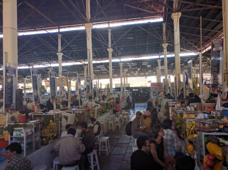 This place reminded me of a swap meet in the USA but Peruvian style. This is a place where mostly locals go with only few tourists. Oscar bought us lunch. We all had fried chicken. It costs about $2 each for lunch and Oscar paid.
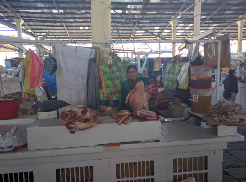
 Oscar and the lady cooking the food both actually thought I was Sean Connery. Figure that one out! Oscar had mentioned it the day before and the cook wanted to take a picture with me - so I did.
Frank and I went back to the hotel and took a nap. About 7 PM we walked back to the Plaza de Armas and walked around a bit.
A celebration was going on - the celebration of the crosses. We did not eat. We came back to the hotel and hit the sack because we had an early flight on Tuesday.
Tuesday 5/3
 We flew back to La Paz, Bolivia. We left for the airport at 4:45 AM. Frank left his phone in Oscar's taxi. Fortunately the LAN ticket agent let Frank use her cell phone to call his. Frank got hold of Oscar and he brought Frank's phone back to the airport and saved the day. The LAN ticket agent was amazed that Oscar did that. She was sure Franks phone was gone forever. Follow this link to get Oscar's phone number if you ever visit Cusco
Cusco Ollantaytambo Aguas Calientes Machu Picchu Peru.
We flew back to La Paz, Bolivia. We left for the airport at 4:45 AM. Frank left his phone in Oscar's taxi. Fortunately the LAN ticket agent let Frank use her cell phone to call his. Frank got hold of Oscar and he brought Frank's phone back to the airport and saved the day. The LAN ticket agent was amazed that Oscar did that. She was sure Franks phone was gone forever. Follow this link to get Oscar's phone number if you ever visit Cusco
Cusco Ollantaytambo Aguas Calientes Machu Picchu Peru.
We arrived in Lima around 8:30 AM. We flew on a Airbus A319. The C17 US military aircraft was gone from the military area of the airport. We ate at McDonalds.
We received a message from Beth that Blue Sheppard and Shannon got married.
We left Lima at 10:20 AM for Santa Cruise, Bolivia and then on to La Paz, Bolivia. When we arrived at the airport we summoned a cab and returned to the Hotel Rosario - a place we were already familiar with. We walked around town and then back to the hotel. Frank went out with Wendy's husband for a while and I watched TV and fell asleep. Frank brought back fried chicken and french fries. Frank had arranged for Wendy to take us yarn shopping tomorrow.
La Paz - Bolivia
Wednesday 5/4 - We had breakfast at the hotel. Wendy came to the hotel and off we went, on foot, looking for alpaca yarn for Beth.
We walked down hill for a while but couldn't find any yarn stores near the hotel so we jumped on a bus and Wendy took us to a fairly new addition to La Paz - the cable car or Mi Teleferico.
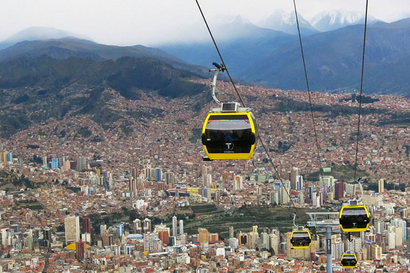
 Constructed in just 2 years with the help of 1,200 full-time workers, the cable car network is being developed by Mi Teleferico at an estimated cost of $234 million. There are currently 3 sky trams in La Paz with more planned where financing is now in place for a further 5 lines.
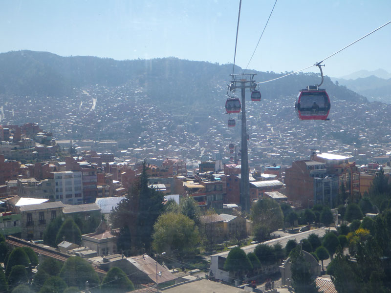
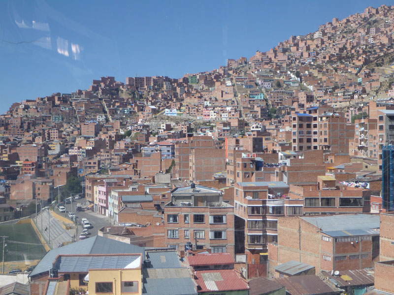
It is estimated that there could be up to 16 lines in the La Paz Teleferico by 2030. The 3 public cable car lines are color coded red, yellow, and green. The red line is the northern line and is 2.4 km (1.5 mi) long. The yellow line is the southern line and is 3.9 km (2.4 mi) long. The green line is the middle line and is 3.7 km (2.3 mi) long. The tram colors are in line with the colors of the Bolivia’s flag. All 3 lines go from the valley that is La Paz to various parts of the high plateau that is El Alto. There are 11 stations in total including a double station that serves as the end of the yellow and the green lines.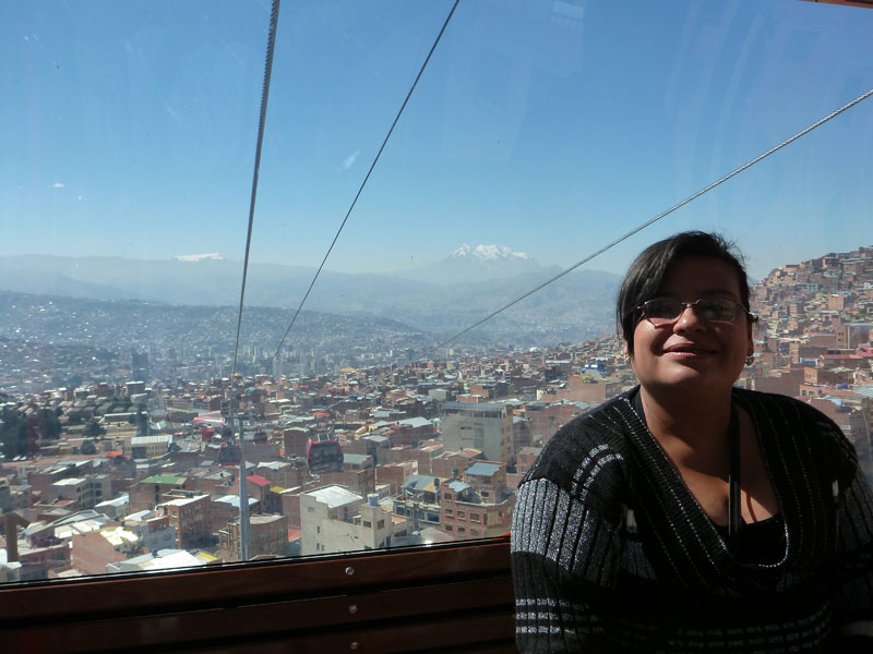
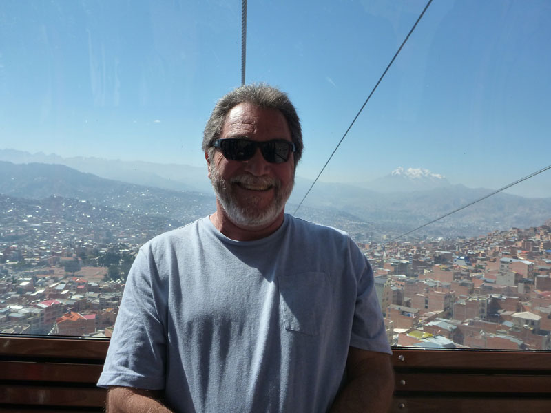
Operating at 4000 m (13,000 ft) above sea level, the world’s highest cable car ride has revolutionised the way locals travel between La Paz and neighbouring El Alto. Transporting 3000 people between the two locations every hour, the cable cars have cut commute times from 1 hour to just 10 minutes. This is important because the vast majority of the population live in El Alto and work in La Paz. Travel costs have also been reduced with a one way cable car ticket costing only 3 bolivianos ($0.43 US) compared to the 5 bolivianos ($0.72 US) charged for a one way bus ticket. I know this sounds inexpensive, in fact, cheap. However, with an average per capita income of $2,800 — as compared to an average of $8,200 for other Latin American countries — Bolivia stands as the poorest nation on the continent where 64% of the country lives below the poverty line. If the average wage earner used the tram 5 days a week in both directions they would spend nearly 10% of their yearly income on the tram alone.
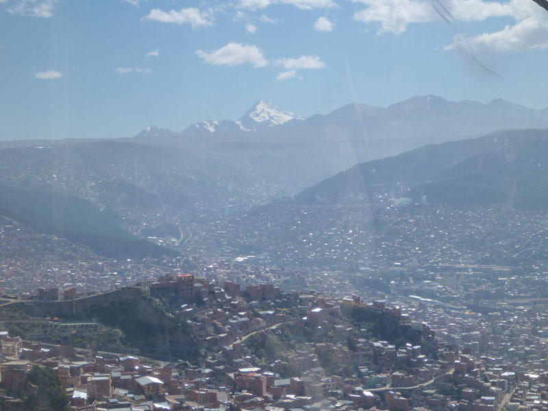
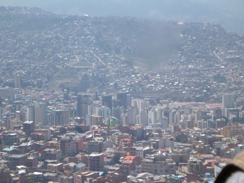
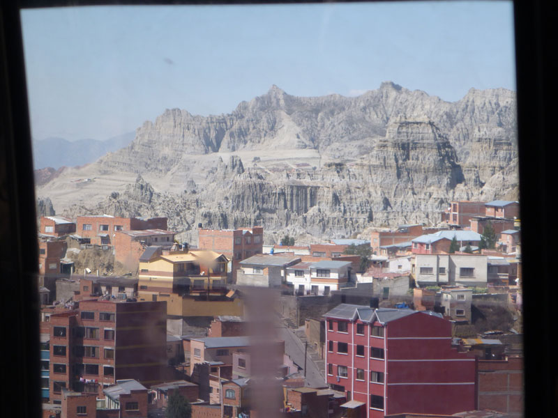 The tram ride provides fantastic views of the city and the surrounding mountains.
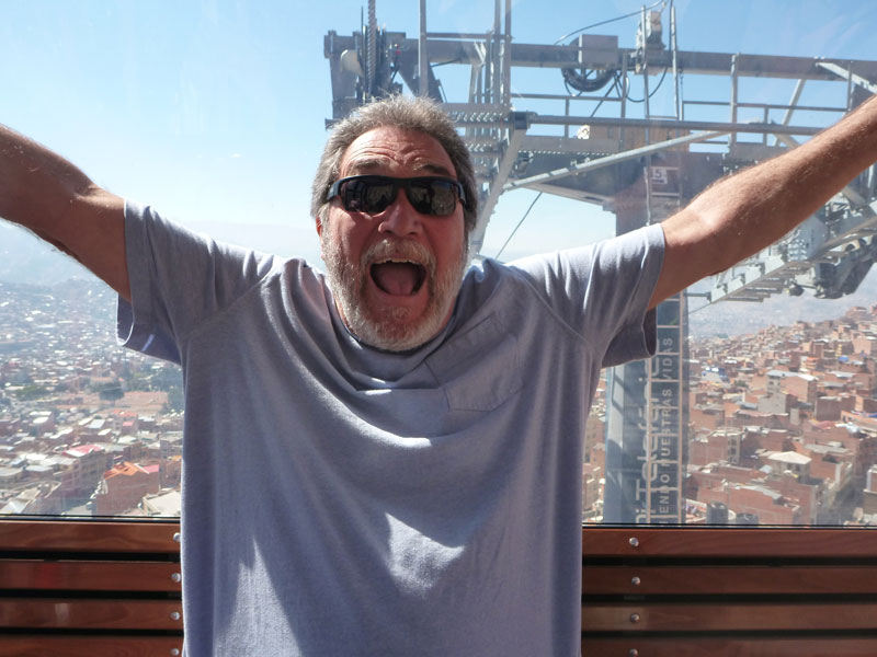 We rode the red line from down in the city up to El Alto.

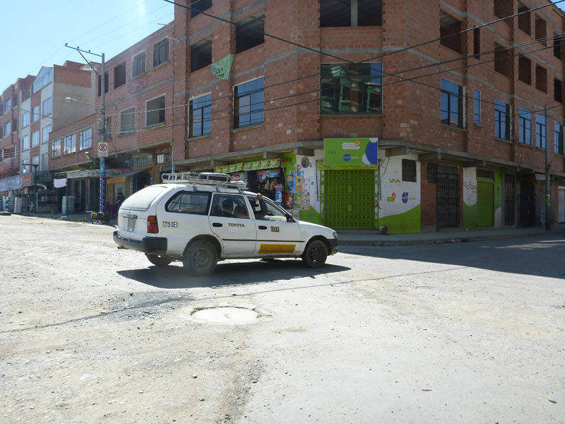 Reaching the top, we took an interesting taxi ride to the other side of El Alto.
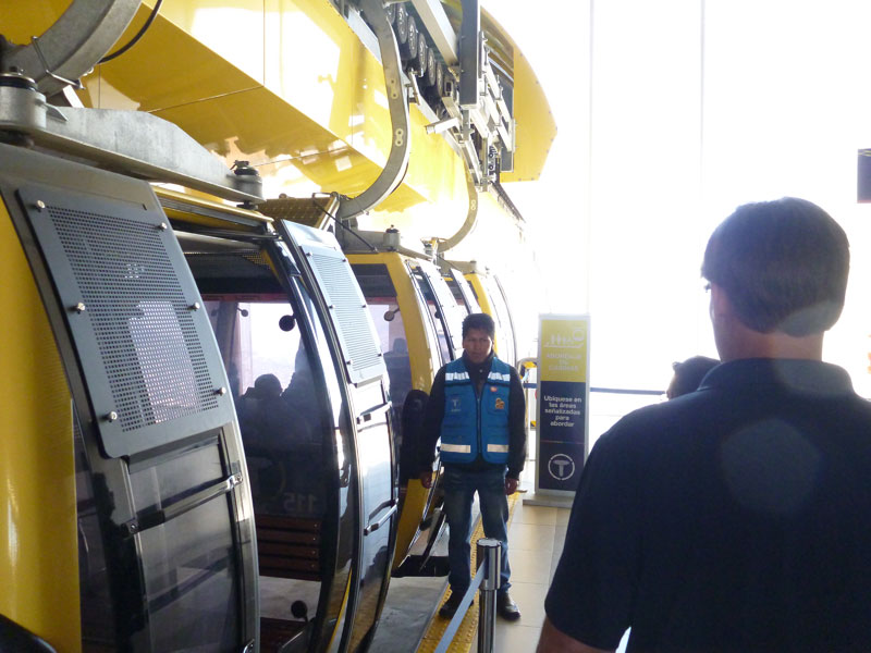
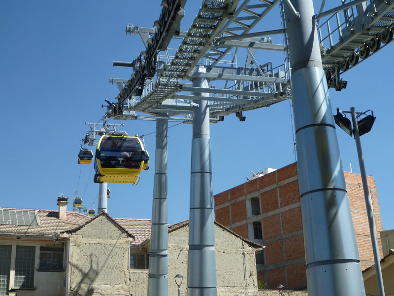
We took the yellow line back down to the center of La Paz.
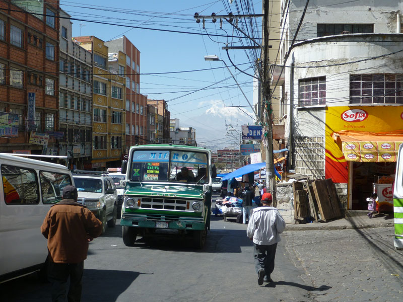
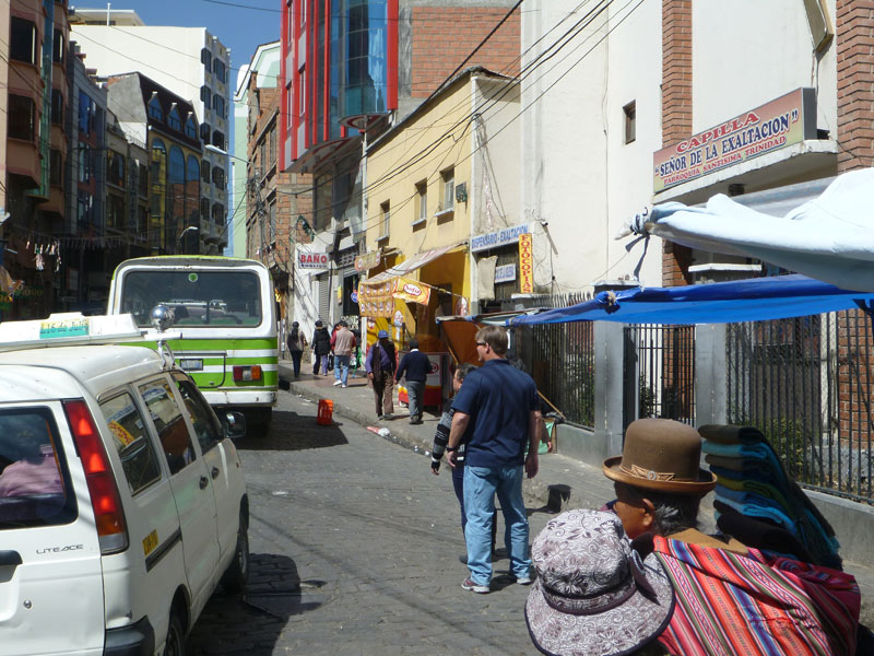 When we got down to La Paz, Wendy summoned a taxi and we were off to a market place where tourists do not go.
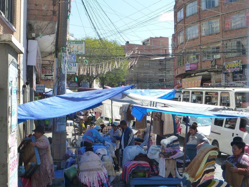
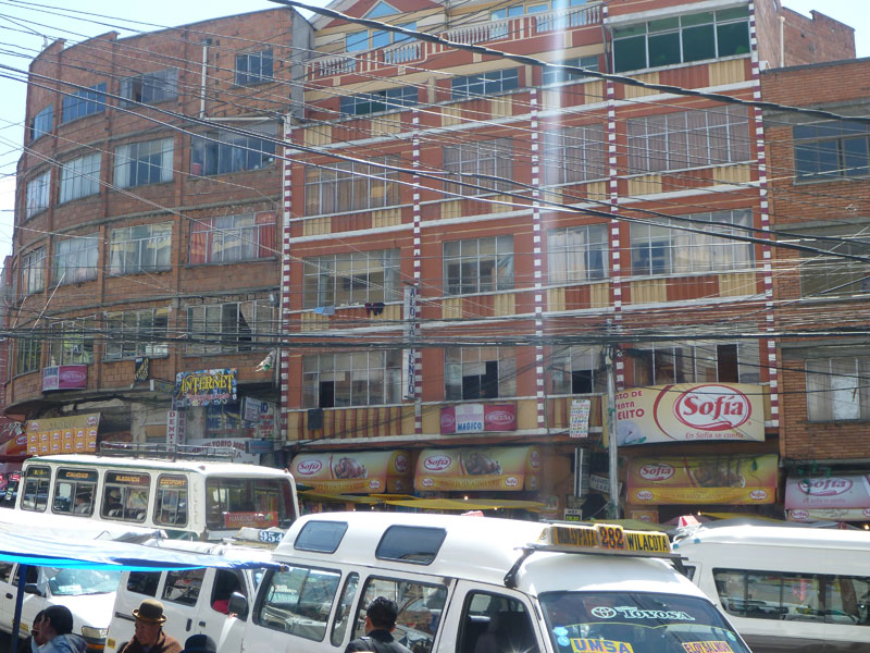 Each street specializes in something. We needed to find the textile street.
We found the shoe street.
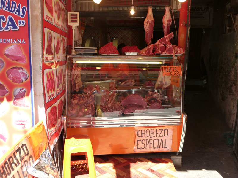
We found the butcher shop street.
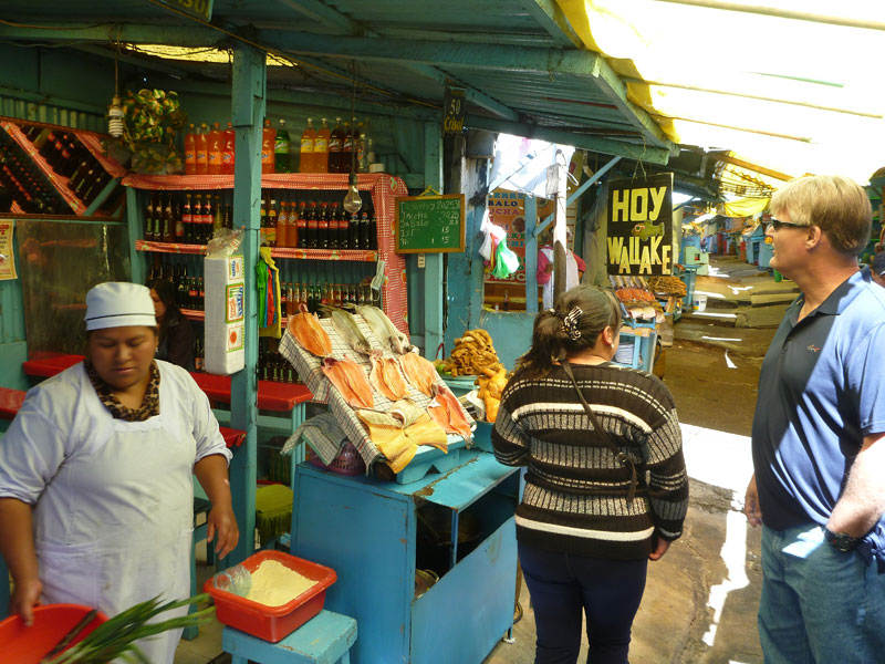
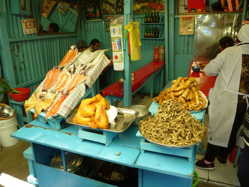 We found the street where anything you could imagine would be cooked for you on the spot.
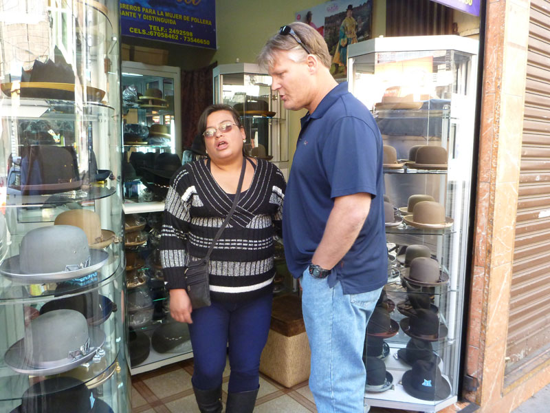 We found the hat street - the businesses that produce the traditional derby style hats worn with traditional clothing. I was going to purchase one but they were quite expensive - more than I wanted to spend.
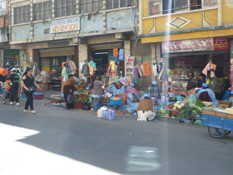
We also walked down the fresh produce street where vendors were selling all sorts of vegetables and farm products.
Wendy finally found the textile street that had more yarn than imaginable. We purchased alpaca and 2 kinds and llama.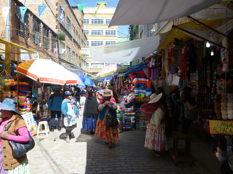
 The total cost was $120. As weird as it seems we ended up just several blocks up hill of the hotel and easily walked back to the hotel and dropped off the yarn.
Then down hill to the center of town. From there Wendy pushed me onto a bus - standing room only - and yelled something to the driver. Up to the top of the hill we went for about 15 minutes. All in a sudden the bus stopped and the driver pointed at me and pointed off of the bus. So, I got off to find myself a block or so above the house of Sonia's sister Gladys. This is where everyone was meeting for dinner and a birthday celebration. Frank and Wendy followed in other buses a few minutes behind. 
We had a wonderful time having dinner and celebrating Sandra's birthday. Thank you all for your hospitality and friendliness.
We got back to the hotel around 5 PM. This is the same hotel we stayed in when we arrived in Bolivia the first time. We packed and got some sleep because we need to be at airport at 3 AM to fly home.
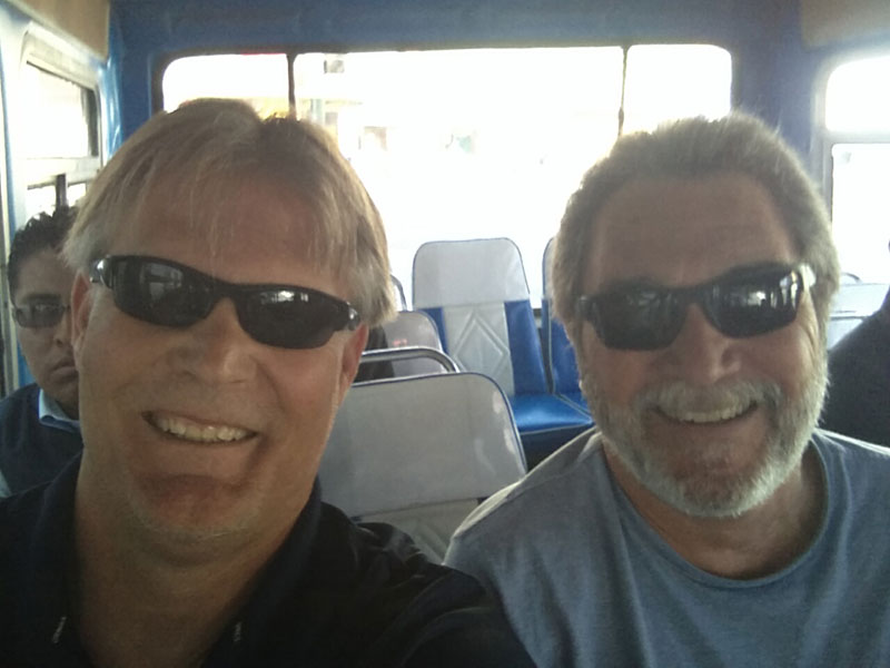
Thanks to Frank's extended family, we had a great time in La Paz.
Thursday 5/5
Today we fly from La Paz, Bolivia to Miami, Florida and then on to Los Angeles, California. We arrived at the La Paz airport at 3:15 AM to find out our flight was 1 hour late. We got through customs and the scan thing where they took my water away from me. I end up having to sit for 3 hours 30 feet from the scan thing and I have to buy water from a vendor for a couple of bucks if I want to have water. This is absolute nonsense. They let my can of Pringles potato chips through the stupid thing. After this 3 hour wait we still have over 12 hours traveling to go. This was probably the first worse part of the trip for me. I did not know there was more worse parts to come. I was already uncomfortable, tired, pissed, and everything else you can imagine.
We flew a Boeing 757-200 from La Paz, Bolivia to Miami, Florida. The flight wasn't too bad. We both had window seats and that helped. I will never go through Miami, Florida again if I can help it. We had to stand in line to go through screening for about 30 minutes. It felt like an hour. A long line - back and forth like Disneyland - 2 lanes open and 3 closed. We didn't see this nonsense in even the poorest of countries. We never waited more than a few minutes anywhere in South America. In Miami $15+ for a stinking hamburger. $6 for a water and a coke. No McDonalds, no Burger King, no Carl's. Everything is expensive unlike South American airports where you can eat for a reasonable price. Miami dade airport sucks! Never again. We then flew from Miami to Los Angeles on a 737-800 cattle car. This too was an arduous leg of the trip. We were cramped like sardines. I could barely move for the 5.5 hour journey. Thank God I had a window seat. Unfortunately the guy next to me was a big guy - a really big guy. I was hugging the side wall and window the entire trip. As you can imagine, I was not a happy camper after that flight. It took a total of 19 hours traveling to get from La Paz, Bolivia to Los Angeles, California.
We arrived home at 11:50 PM exhausted. Customs at LAX was painless and quick. Beth picked us up in front of the Bradley terminal at LAX. We were home in 30 minutes.
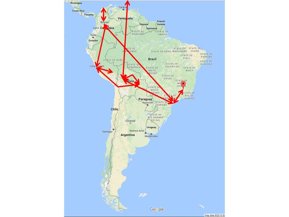 Total air travel this trip was about 11,000 miles in South America. Los Angeles to Miami to La Paz was about 5,340 miles times 2 is 10,680 miles. This brought the total to 21,680 air miles in all.
Now let me blow your mind!
Try to wrap your head around this.

At the equator the earth spins at 1000 miles per hour = 1609 kilometers per hour.
The earth rotates around the sun at about 67,000 miles per hour = 107,826 kilometers per hour.
The sun with all of the planets rotate around the galaxy at about 559,000 miles per hour (250 km/s according to Vera Rubin, the lady who discovered this in the 1970's). In fact, the majority of the suns in all galaxies rotate around their respective black hole very close to this same speed. One would expect the rotation to be much like our solar system where the outer planets rotate slower and the inner planets rotate faster. Not so for the stars in a galaxy. Stars, at many varying distances from the black hole at the galaxy center, are all rotating at the same speed. This results in the pinwheel shapes common to most galaxies. No one really knows exactly why this is. It is being explained as the result of dark matter. Because of this, Rubin is credited with discovering dark matter - something we have no idea what it is, but we can see its effect on stars in galaxies.

Our galaxy, along with the local group of galaxies, is moving through space at about 1,340,000 miles per hour = 2,156,521 kilometers per hour.
Astronomers speculate that space is expanding at about 152,112 miles per hour = 244,801 kilometers per hour.
Add it all up and we are traveling through space at more than 2,000,000 miles per hour = 3,218,688 kilometers per hour. Other estimates say upwards of 2.8 million miles per hour = 4.5 million kilometers per hour. That is somewhere between 550 and 800 miles per second = 1,288 kilometers per second. At that speed you could travel from the earth to the moon, 238,900 miles away, in under 6 minutes. In any case, it is fast - damn fast.
It's hard to imagine traveling that fast. It's impossible to relate to these speeds especially when we feel like we are standing still in space.
As a comparison, the speed of light is 6.706e+8 mph or 670,600,000 miles per hour which is about 671 million miles per hour or about 186,000 miles per second ~ 300,000 kilometers per second.
That is about 300 times faster than we are traveling through space.
Something I should also mention is that in addition to moving through space at such an extreme speed, our sun with the planets moves up and down through the plane of our galaxy like a merry go round while traveling around the galaxy. This merry go round up and down oscillation is on a 60,000 year cycle. So, this up and down movement through the plane of the Milky Way Galaxy takes us into areas of our galaxy that may be less desirable than others. It could take us through debris clouds or near magnetars or black holes that could cause havoc in various catastrophic ways for the earth.
Why Is Earth's Weather Changing?
Now let's look at the Earth's path through space and how it affects the weather. Global warming or cooling - absolutely. Manmade - a little but nothing like earth itself. No doubt humankind is contributing to weather change, but the earth's orbit will override and exceed anything man will do.
Why you ask?
The Earth's rotational axis is tilted slightly at 23.5 degrees. The Earth's axis rotates around this circle once every 20,000 years. The north star today is Polaris, however, 5 thousand years ago it was a different star altogether (Theban) and thousands of years from now it will be Vega. Today the orientation is the northern hemisphere is leaning away from the sun. This position is why the Sarah Desert is a desert where it was more tropical, wet, and green 15,000 years ago.

 The north star today is Polaris, however, 5 thousand years ago it was a different star altogether (Theban) and thousands of years from now it will be Vega. Today the orientation is the northern hemisphere is leaning away from the sun. This position is why the Sarah Desert is a desert where it was more tropical, wet, and green 15,000 years ago.

The Earth's orbit around the sun is also not constant and varies widely over time. Today the Earth's orbit around the sun is almost circular so summers and winters are mild.
However, due to influences from the Sun and moon, Earth's orbit can go slightly elliptical. The cycle between elliptical and circular is 100,000 years. The effect of this orbital change will be hotter summers and colder winters.
Jupiter and Mars have an even bigger effect on Earth's orbit where a 405,000 year cycle takes the Earth's orbit on an extremely elliptical orbit. This orbit is thought to have been responsible for snowball earth several times in Earth's past.
Yes, Earth's climate is changing, and it is going to change way more dramatically than any of us can imagine. All these orbital changes have happened several times in the past and will happen again many more times in the future. 20,000 years from now there will be vast changes where the Sarah Desert will be green again. But these changes will be the result of the Earth's orbit around the Sun and will probably have little to do with human evolution.
Another event not often associated with weather disturbances is the occasional flip of earth's magnetic field known as geomagnetic reversal. Earth's magnetic poles are not static. The magnetic poles wander and occasionally reverse around every 200,000 to 300,000 years. The Earth's magnetic field has reversed nine times during the past four million years. The last known complete 180-degree magnetic pole shift last happened 42,000 years ago and took approximately 1000 years to complete the shift. As of late, Earth's magnetic North pole has wandered considerably on a path toward northern Russia. Scientists know that Earth's magnetic field has weakened about 9% in the past 170 years. The magnetic North pole has also been drifting more rapidly since the 1990s, at a rate of 30 to 40 miles per year.
The pole shift 42,000 years ago is suspected to have contributed to the demise of Neanderthal�s. While the poles were shifting, additional cosmic rays and high-energy particles from outer space would have depleted ozone concentrations, opening the floodgates for more ultraviolet radiation in the atmosphere over a long period of time. Shifting weather would have expanded the ice sheet over North America and dried out Australia, prompting the extinction of many large mammal species. Solar storms, meanwhile, might have driven ancient humans to seek shelter in caves. As competition for resources grew, our closest extinct human relative, Neanderthals, may have died out.
Problems in the near term.
Because the moon orbits the earth and the moon and earth orbit the sun, the two celestial bodies that affect earth the most are the moon and the sun. They line up in ways that influence how gravity acts on the earth. The phenomenon is what causes ocean tides to wax and wane. This gravitational pull differs from year to year.
To us, the moon appears to �wobble� in space. This is due to the tilt, velocity and shape of the moon's orbit which takes 18.6 years to complete. Half of the cycle suppresses tide activity by making high tides lower than normal and low tides higher than normal.
But the other half exacerbates them. Therein lies the problem.
According to NASA. the moon is currently in the �tide-amplifying part of its cycle�. By mid-2030, when this intensified series returns, people living in coastal cities may be dealing with severe floods �every day or two.�
Why you ask?
This natural yet amplified lunar cycle will be coupled with higher sea levels caused by global warming, triggering a decade of dramatic surges in the number of days with high-tide flooding on nearly all mainland coastlines in the world.
High-tide flooding is projected to exceed thresholds across the world more often and occur in clusters that last a month or longer, the NASA Sea Level Change Science Team of the University of Hawaii said. Their study was published last month in the journal Nature Climate Change.
These kinds of floods are already plaguing many cities on the Atlantic and Gulf coasts. In 2019, the National Oceanic and Atmospheric Administration reported more than 600 such floods, which occur when high tides reach about 2 feet above the daily average �and start spilling onto streets or bubbling up from storm drains.�
The problem, researchers say, is that these events are often considered less important or damaging than floods caused by hurricanes, for example, because they involve smaller amounts of water.
But �it�s the accumulated effect over time that will have an impact,� study lead author Phil Thompson, an assistant professor at the University of Hawaii, said in a statement. �If it floods 10 or 15 times a month, a business can�t keep operating with its parking lot under water. People lose their jobs because they can�t get to work. Seeping cesspools become a public health issue.�
What�s more, these repeated events will eventually occur in clusters in about a decade when the moon�s amplified wobble merges with future higher seas, the team says. The dangerous cocktail is predicted to spark increased high-tide flooding over a short period of time, creating extreme months of activity.
The bottom line - the world is headed for coastal flooding without rising sea levels. With rising sea levels coastal catastrophe is eminent.
We know greenhouse gases can change the climate based on multiple lines of scientific evidence point to the increase in greenhouse emissions over the past century and a half as a driver of long-term climate change around the world. Laboratory measurements since the 1800s have repeatedly verified and quantified the absorptive properties of carbon dioxide that allow it to trap heat in the atmosphere. Simple models based on the warming impact of carbon dioxide in the atmosphere match historical changes in temperature. Complex climate models, recently acknowledged in the Nobel Prize for Physics, not only indicate a warming of the Earth due to increases in carbon dioxide but also offer details of the areas of greatest warming. Long-term records from ice cores, tree rings and corals show that when carbon dioxide levels have been high, temperatures have also been high. The chart below shows the change in temperature vs CO2 levels over time. It is an obvious correlation.
Does the below graphic concern anyone?
Fires across Canada - summer 2023